
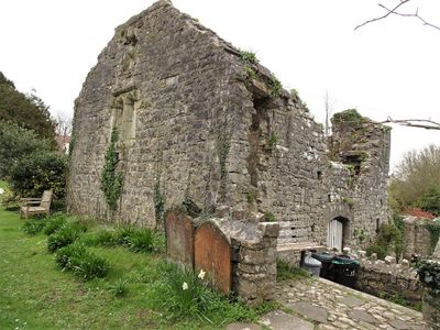
Former Chantry Priest's House, Grade II listed building in Vale of Glamorgan. About 30m south of the south porch of the Church of St Illtud
Emplacement : Llantwit Major
Altitude : 35,8 m
Coordonnées GPS : 51.40774,-3.48773
Dernière mise à jour : 3 mars 2025 à 11:16

St Illtyd's Church, Llantwit Major
30 m
Llantwit Major Town Hall
121 m
Well opposite Downcross Farm
448 m
Bethel Baptist Chapel
243 m
Tudor Tavern P.H.
104 m
The Old Police Station
61 m
Old White Hart P.H.
97 m
Old Swan Inn
137 m
Llantwit Major War Memorial
105 m
West Farmhouse
231 m
Tabernacle Calvinistic Methodist Chapel
152 m
Cross in Churchyard of Church of St. Illtud
17 m
Court House
285 m
Plymouth House
168 m
Telephone Call-Box outside Old White Hart P.H.
109 m
Downcross Farmhouse including front garden walls
463 m
Old Place (or Llantwit Major Castle)
340 m
Ty-mawr
545 m
Outhouse at Sunny Bank
419 m
Footbridge over brook at West entrance to churchyard of Church of St Illtud
42 m
Swimbridge Farmhouse with attached garden walls
221 m
The Gatehouse (porter's Room)
61 m
Corner House
345 m
The Old School, including attached walling
113 m
Llantwit Major Dovecote
107 m
Chantry House
28 m
Quaintways, with attached garden wall
237 m
The Old House
367 mAvis
Vous avez visité ce lieu ? Touchez les étoiles pour le noter et partager votre expérience ou vos photos avec la communauté ! Essayez maintenant ! Vous pouvez annuler à tout moment.
Trouvez des trésors cachés à chaque coin de rue !
Des petits cafés pittoresques aux points de vue planqués, fuyez la foule et dénichez les lieux qui vous ressemblent vraiment. Notre app vous facilite la vie : recherche vocale, filtres malins, itinéraires optimisés et bons plans partagés par des voyageurs du monde entier. Téléchargez vite pour vivre l'aventure en version mobile !

Une approche inédite de la découverte touristique❞
— Le Figaro
Tous les lieux qui valent la peine d'être explorés❞
— France Info
Une excursion sur mesure en quelques clics❞
— 20 Minutes