
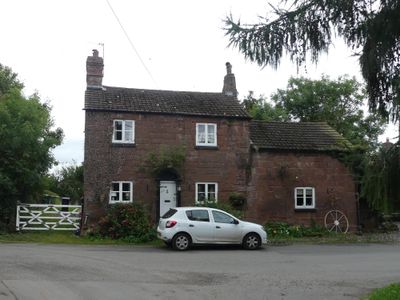
Stone Cottage and attached outbuilding and boundary wall
Stone Cottage and attached outbuilding and boundary wall, Grade II listed cottage in Shotwick, Cheshire West and Chester, Cheshire, UK
Emplacement : Puddington
Coordonnées GPS : 53.23944,-2.99348
Dernière mise à jour : 6 mars 2025 à 19:22

RAF Sealand
1.9 km
Shotwick Castle
1.8 km
Shotwick House
2.5 km
St Michael's Church, Shotwick
130 m
Shotwick Hall
213 m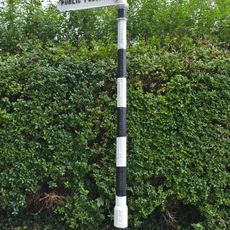
Footpath Guidepost At Junction With Parkgate Road
2.4 km
Gates, gatepiers and churchyard wall along north side of Shotwick Lane
149 m
Front garden walls and gatepiers at Shotwick Hall
212 m
Tombchest of Robert and Martha Ellison, 10 metres southwest of south corner of tower of Church of St Michael
160 m
Manor Farmhouse
23 m
L-shaped ranges of farm buildings 60 metres north of Shotwick Hall
284 m
Footpath Guidepost At Junction Of Pipers Lane Opposite The White House
1.9 km
Granary 30 metres east of Shotwicklodge Farmhouse
1.4 km
Sundial in the churchyard of St Michael
152 m
Greyhound Farmhouse
36 m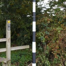
Footpath guidepost 50m east of Heath farmhouse
2.5 km
Tombchest of James Phillips, 2 metres south of the sundial in the Churchyard of St Michael
154 m
Former kitchen or bakehouse attached to north east corner of Shotwick Hall
231 m
Tombchest of Rev M Reay and 4 children, 8 metres south of south porch of Church of St Michael
145 m
Tombchest of John Nevett Bennett, 5 metres west of south porch of St Michael's Church
148 m
Tombchest of William Briscoe (died 1723) and others, 4 metres west of priest's door to St Michael's Church
136 m
Vicarage Farmhouse
79 m
Footpath Guidepost 5 Metres North Of Top Lodge
1.7 km
Barn 70 metres north east of Shotwicklodge Farmhouse
1.4 km
Tombchest of William Briscoe (died 1704) and others, 5 metres southwest of priest's door to St Michael's Church
136 m
North Pair of Aircraft Hangars
1.6 km
South Pair of Aircraft Hangars
1.7 km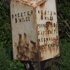
Milepost, Parkgate Road, Woodbank
2.2 kmAvis
Vous avez visité ce lieu ? Touchez les étoiles pour le noter et partager votre expérience ou vos photos avec la communauté ! Essayez maintenant ! Vous pouvez annuler à tout moment.
Trouvez des trésors cachés à chaque coin de rue !
Des petits cafés pittoresques aux points de vue planqués, fuyez la foule et dénichez les lieux qui vous ressemblent vraiment. Notre app vous facilite la vie : recherche vocale, filtres malins, itinéraires optimisés et bons plans partagés par des voyageurs du monde entier. Téléchargez vite pour vivre l'aventure en version mobile !

Une approche inédite de la découverte touristique❞
— Le Figaro
Tous les lieux qui valent la peine d'être explorés❞
— France Info
Une excursion sur mesure en quelques clics❞
— 20 Minutes