
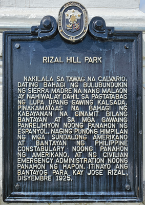
Rizal Hill Park historical marker
Rizal Hill Park historical marker, NHCP historical marker for Rizal Hill Park
Emplacement : Mauban
Création : 2011
Créateur : National Historical Commission of the Philippines
Coordonnées GPS : 14.18917,121.73097
Dernière mise à jour : 11 mars 2025 à 14:04
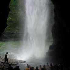
Pagsanjan Falls
26.2 km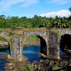
Malagonlong Bridge
23.2 km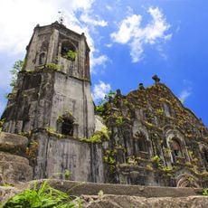
Lucban Church
20.8 km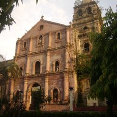
Majayjay Church
28.4 km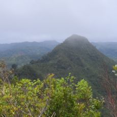
Quezon Protected Landscape
17.5 km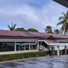
Nawawalang Paraiso
23.3 km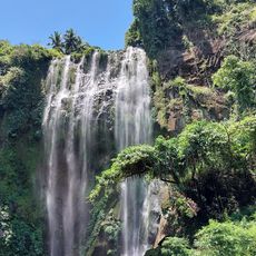
Hulugan Falls
27.2 km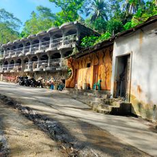
Dalitiwan Resort
26.2 km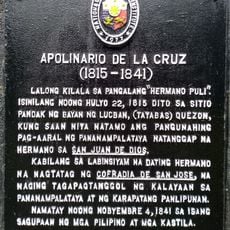
Apolinario de la Cruz historical marker
20.6 km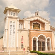
Mauban Church
143 m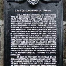
Casa de Comunidad de Tayabas historical marker
23.6 km
Lucban Municipal Hall
20.8 km
La Doña Ana
20.7 km
Casa Comunidad of Tayabas
23.6 km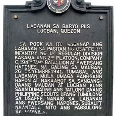
Battle of Barrio Piis historical marker
15.3 km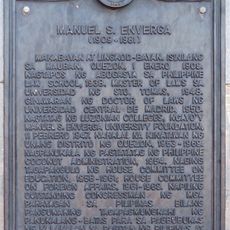
Manuel S. Enverga historical marker
217 m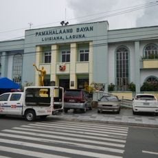
Luisiana Municipal Hall
23.9 km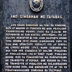
The Church of Tayabas historical marker
23.6 km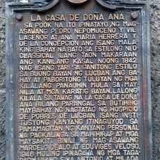
La Casa de Doña Ana historical marker
20.7 km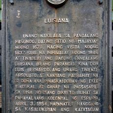
Luisiana historical marker
23.9 km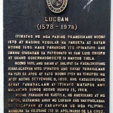
Lucban historical marker
20.8 km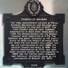
Church of Mauban historical marker
138 m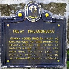
Malagonlong Bridge historical marker
23.2 km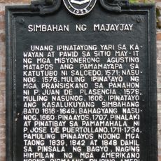
Church of Majayjay historical marker
28.4 km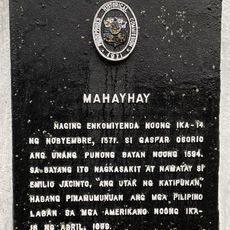
Majayjay historical marker
28.4 km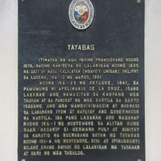
Tayabas historical marker
23.6 km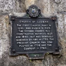
Church of Lucban historical marker
20.8 km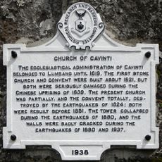
Church of Cavinti historical marker
24.9 kmAvis
Vous avez visité ce lieu ? Touchez les étoiles pour le noter et partager votre expérience ou vos photos avec la communauté ! Essayez maintenant ! Vous pouvez annuler à tout moment.
Trouvez des trésors cachés à chaque coin de rue !
Des petits cafés pittoresques aux points de vue planqués, fuyez la foule et dénichez les lieux qui vous ressemblent vraiment. Notre app vous facilite la vie : recherche vocale, filtres malins, itinéraires optimisés et bons plans partagés par des voyageurs du monde entier. Téléchargez vite pour vivre l'aventure en version mobile !

Une approche inédite de la découverte touristique❞
— Le Figaro
Tous les lieux qui valent la peine d'être explorés❞
— France Info
Une excursion sur mesure en quelques clics❞
— 20 Minutes