
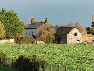
Ferry Bank Farm, Grade II listed building in Flintshire. Located on Fox's Drive which leads E from Welsh Road (B5441). The gable end of the farmhouse fronts the road
Emplacement : Sealand
Altitude : 5 m
Coordonnées GPS : 53.21156,-3.00701
Dernière mise à jour : 5 mars 2025 à 13:55

Gladstone's Library
3.2 km
Deeside Leisure Centre
1.4 km
RAF Sealand
1.4 km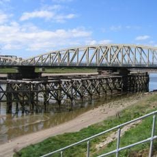
Hawarden Bridge
1.9 km
St Deiniol's Church
3.1 km
Shotwick Castle
2.7 km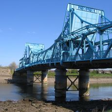
Jubilee Bridge
625 m
St Michael's Church, Shotwick
3.1 km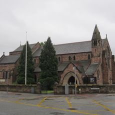
St Ethelwold's Church, Shotton
1.9 km
St David's Church, Connah's Quay
3.1 km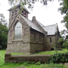
St Bartholomew's Church, Sealand
2.4 km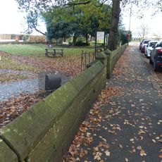
Churchyard boundary wall, Church of St Bartholomew
2.4 km
Deeside Library
1.4 km
Connah's Quay and Shotton War Memorial
2.5 km
Gates, gatepiers and churchyard wall along north side of Shotwick Lane
3.1 km
Tombchest of Robert and Martha Ellison, 10 metres southwest of south corner of tower of Church of St Michael
3.1 km
Tombchest of Rev M Reay and 4 children, 8 metres south of south porch of Church of St Michael
3.1 km
Tombchest of John Nevett Bennett, 5 metres west of south porch of St Michael's Church
3.1 km
Tombchest of James Phillips, 2 metres south of the sundial in the Churchyard of St Michael
3.1 km
Sundial in the churchyard of St Michael
3.1 km
Blessed Sacrament
2.9 km
Tombchest of William Briscoe (died 1723) and others, 4 metres west of priest's door to St Michael's Church
3.1 km
Office Building, Corus Steelworks
1.7 km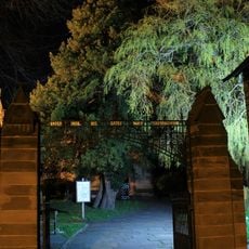
Entrance Gates and Churchyard Walls at Saint Deiniol's Parish Church, Church Lane (Far End)
3.2 km
North Pair of Aircraft Hangars
1.6 km
Tombchest of William Briscoe (died 1704) and others, 5 metres southwest of priest's door to St Michael's Church
3.1 km
South Pair of Aircraft Hangars
1.5 km
Vicarage Farmhouse
3.2 kmVous avez visité ce lieu ? Touchez les étoiles pour le noter et partager votre expérience ou vos photos avec la communauté ! Essayez maintenant ! Vous pouvez annuler à tout moment.
Trouvez des trésors cachés à chaque coin de rue !
Des petits cafés pittoresques aux points de vue planqués, fuyez la foule et dénichez les lieux qui vous ressemblent vraiment. Notre app vous facilite la vie : recherche vocale, filtres malins, itinéraires optimisés et bons plans partagés par des voyageurs du monde entier. Téléchargez vite pour vivre l'aventure en version mobile !

Une approche inédite de la découverte touristique❞
— Le Figaro
Tous les lieux qui valent la peine d'être explorés❞
— France Info
Une excursion sur mesure en quelques clics❞
— 20 Minutes