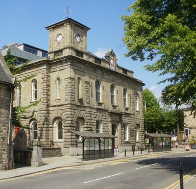
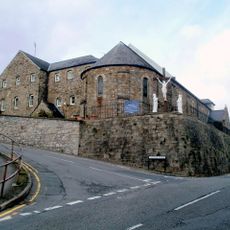
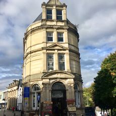
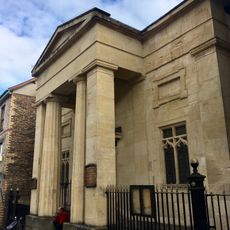
Town Hall, Grade II listed building in Torfaen County Borough. In the centre of Pontypool at the junction of Hanbury Road and Glentorvaen Road
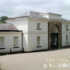
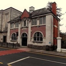
L'hôtel de ville est un édifice en pierre de style italianisant construit au milieu des années 1800 et ouvert en 1856. La façade compte cinq sections inégales, le côté gauche se projetant légèrement avec une petite tour d'horloge, le côté droit en retrait, tandis que l'entrée centrale est encadrée par de hautes colonnes et un arc.
Le bâtiment a été fondé en 1854 en tant que cadeau du Lord Tenant Capel Hanbury Leigh pour marquer la naissance de son fils, et ouvert en 1856 avec un concert formel. Au cours du 20e siècle, il est devenu le siège principal du gouvernement local et a été agrandi par la suite.
L'hôtel de ville a fonctionné comme lieu de rencontre où les habitants se rassemblaient pour des réunions civiques et des célébrations locales. Il reste connecté à la vie collective de Pontymoile.
Le bâtiment est accessible par Hanbury Road et bénéficie d'un statut protégé qui préserve ses caractéristiques historiques. Les visiteurs doivent savoir qu'il fonctionne comme centre gouvernemental actif, l'accès peut donc être limité.
La pierre de fondation a été posée en 1854 par Mme Hanbury Leigh, et la célébration d'ouverture a été un élégant concert en soirée plutôt qu'une cérémonie traditionnelle. Cela a été significatif car Pontymoile n'avait jamais eu de lieu public dédié aux réunions.
La communauté des voyageurs curieux
AroundUs rassemble des milliers de lieux sélectionnés, conseils locaux et pépites cachées, enrichis chaque jour par plus de 60,000 contributeurs à travers le monde.