67, 68 And 69, The Street, building in Boxgrove, Chichester, West Sussex, UK
Emplacement : Boxgrove
Coordonnées GPS : 50.85927,-0.71286
Dernière mise à jour : 22 novembre 2025 à 15:38
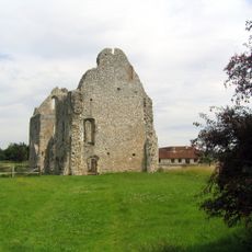
Prieuré de Boxgrove
187 m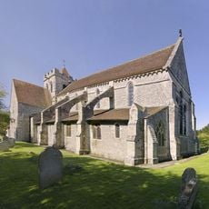
The Priory Church of St Mary and St Blaize, Bloxworth
155 m
South East Gateway To The Goodwood Estate, Adjoining Park Lane
668 m
72 and 73, Church Lane
85 m
The Anglesey Inn
723 m
Nightingale Cottage
115 m
Rose Cottage And Jasmine Cottage
706 m
Old Forge Cottage
736 m
Thatch Cottage
100 m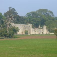
Halnaker House
870 m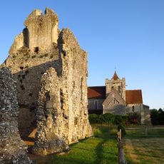
Boxgrove Priory
146 m
Tangmere Cottage
1 km
46 And 47, Petworth Road
933 m
Devil's Ditch, section extending 1730yds (1580m) from Stane Street to NW end of Redvin's Copse
1 km
Priory Farmhouse
206 m
Pear Tree House
897 m
48 And 49, Petworth Road
907 m
The Spitfire Club
826 m
64 And 65, The Street
101 m
Broadlands
889 m
Rosetree House
269 m
The Countess Of Derby's Almshouses
175 m
Raf Tangmere: Barrack Block (Building 116) To The Former Raf Airbase
792 m
Elm Cottage
243 m
70 and 71, Church Lane
59 m
Baffles Cottage Old Chimney
1 km
40 And 41, Petworth Road
703 m
Swan Tea Room The Old Store
645 mAvis
Vous avez visité ce lieu ? Touchez les étoiles pour le noter et partager votre expérience ou vos photos avec la communauté ! Essayez maintenant ! Vous pouvez annuler à tout moment.
Trouvez des trésors cachés à chaque coin de rue !
Des petits cafés pittoresques aux points de vue planqués, fuyez la foule et dénichez les lieux qui vous ressemblent vraiment. Notre app vous facilite la vie : recherche vocale, filtres malins, itinéraires optimisés et bons plans partagés par des voyageurs du monde entier. Téléchargez vite pour vivre l'aventure en version mobile !

Une approche inédite de la découverte touristique❞
— Le Figaro
Tous les lieux qui valent la peine d'être explorés❞
— France Info
Une excursion sur mesure en quelques clics❞
— 20 Minutes