Canal Bridge, pont situé au Royaume-Uni
Emplacement : Shrivenham
Coordonnées GPS : 51.58977,-1.65846
Dernière mise à jour : 18 novembre 2025 à 07:14
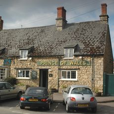
Prince Of Wales Public House
1.1 km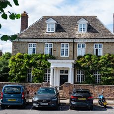
Elm Tree House
1.1 km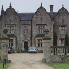
Bourton Grange
1 km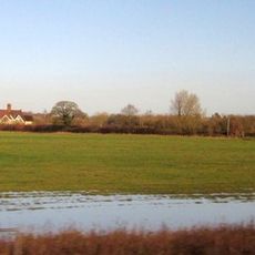
Cowleaze Farmhouse
749 m
Bourton Grange, Gate Piers And Attached Wall Turning From South East Corner
1 km
Oakwood House And The Close
1 km
The White House
1 km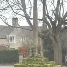
Bourton village cross
1.1 km
Highlands And The Old Manor House
1.1 km
49 And 51, High Street
940 m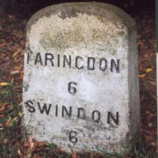
Milestone, Townsend Road; at entrance to Ryme's House
740 m
Bourton Grange, Gate Piers And Attached Walls Approximately 20 Metres East
990 m
Village School
1.1 km
The Chestnuts
1.1 km
44,46 And 48, High Street
991 m
Bourton Bridge (MLN1/72 15)
1.1 km
Old Thatch
986 m
40 And 42, High Street
1 km
Nos. 15 (Dodds Cottage), 17 And 19 (Lilac Cottage)
1 km
20, High Street
1.1 km
The Firs
1.1 km
The Memorial Hall
930 m
29 And 31, High Street
1 km
Ivy House
973 m
Fern House
1.1 km
Stainswick Farmhouse
962 m
The Cottage
784 m
Village Pound Approximately 30 Metres West Of Junction With Fairthorne Way
863 mAvis
Vous avez visité ce lieu ? Touchez les étoiles pour le noter et partager votre expérience ou vos photos avec la communauté ! Essayez maintenant ! Vous pouvez annuler à tout moment.
Trouvez des trésors cachés à chaque coin de rue !
Des petits cafés pittoresques aux points de vue planqués, fuyez la foule et dénichez les lieux qui vous ressemblent vraiment. Notre app vous facilite la vie : recherche vocale, filtres malins, itinéraires optimisés et bons plans partagés par des voyageurs du monde entier. Téléchargez vite pour vivre l'aventure en version mobile !

Une approche inédite de la découverte touristique❞
— Le Figaro
Tous les lieux qui valent la peine d'être explorés❞
— France Info
Une excursion sur mesure en quelques clics❞
— 20 Minutes