
Village Pound Approximately 30 Metres West Of Junction With Fairthorne Way
Village Pound Approximately 30 Metres West Of Junction With Fairthorne Way, building in Shrivenham, Vale of White Horse, Oxfordshire, UK
Emplacement : Shrivenham
Coordonnées GPS : 51.59752,-1.65833
Dernière mise à jour : 18 novembre 2025 à 05:19
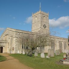
Église Saint André
417 m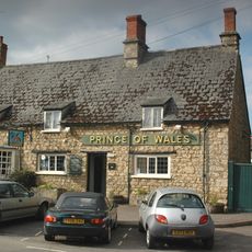
Prince Of Wales Public House
402 m
Jasmine Cottage
374 m
Normanby Cottage
545 m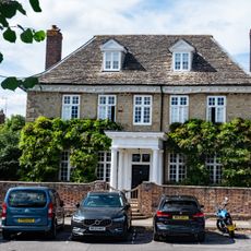
Elm Tree House
333 m
Oakwood House And The Close
356 m
The White House
284 m
2 And 4, Faringdon Road
554 m
13, High Street
452 m
49 And 51, High Street
167 m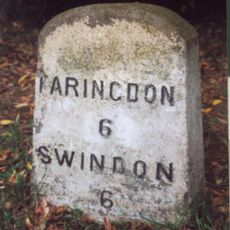
Milestone, Townsend Road; at entrance to Ryme's House
567 m
1-13, Longcot Road
563 m
Piers And Gates To East Of The Church Of St Andrew
464 m
The Firs
417 m
20, High Street
380 m
Nos. 15 (Dodds Cottage), 17 And 19 (Lilac Cottage)
235 m
Old Thatch
174 m
40 And 42, High Street
250 m
Church House
465 m
Shrivenham House
462 m
44,46 And 48, High Street
231 m
8, 10, 14, 18, 24, Claypits Lane
498 m
The Memorial Hall
67 m
The Chestnuts
426 m
29 And 31, High Street
334 m
Ivy House
239 m
Fern House
319 m
The Cottage
154 mAvis
Vous avez visité ce lieu ? Touchez les étoiles pour le noter et partager votre expérience ou vos photos avec la communauté ! Essayez maintenant ! Vous pouvez annuler à tout moment.
Trouvez des trésors cachés à chaque coin de rue !
Des petits cafés pittoresques aux points de vue planqués, fuyez la foule et dénichez les lieux qui vous ressemblent vraiment. Notre app vous facilite la vie : recherche vocale, filtres malins, itinéraires optimisés et bons plans partagés par des voyageurs du monde entier. Téléchargez vite pour vivre l'aventure en version mobile !

Une approche inédite de la découverte touristique❞
— Le Figaro
Tous les lieux qui valent la peine d'être explorés❞
— France Info
Une excursion sur mesure en quelques clics❞
— 20 Minutes