Apalit, commune des Philippines
Apalit est une municipalité de la province de Pampanga sur l'île de Luzon, servant de centre administratif local pour les communautés environnantes. La ville présente des quartiers résidentiels, des terres agricoles et de petites zones commerciales qui reflètent le rythme de la vie quotidienne de la région.
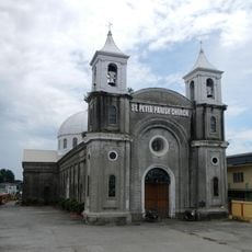
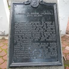
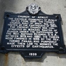
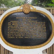
Comme l'une des plus anciennes municipalités de Pampanga, Apalit est ancrée dans l'histoire coloniale de la région façonnée par la colonisation espagnole. Au fil du temps, elle s'est transformée comme de nombreuses autres villes de la province en un centre de gouvernance locale et de commerce.
La ville est facile à parcourir à pied et offre de bonnes opportunités pour observer l'infrastructure locale et l'activité quotidienne. Les visiteurs trouveront des marchés locaux et des services qui répondent aux besoins pratiques de la communauté.
La communauté des voyageurs curieux
AroundUs rassemble des milliers de lieux sélectionnés, conseils locaux et pépites cachées, enrichis chaque jour par plus de 60,000 contributeurs à travers le monde.