Lilyfields, building in Warehorne, Ashford, Kent, UK
Emplacement : Warehorne
Coordonnées GPS : 51.06383,0.83086
Dernière mise à jour : 23 novembre 2025 à 23:05
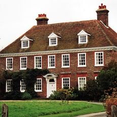
Leacon Hall
240 m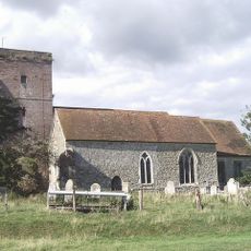
Church of St Matthew
868 m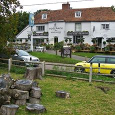
The Woolpack Inn
811 m
Kenardington
1.3 km
Bluebell Cottage
308 m
Headstone To Margaret Burges, About 4 Metres South Of Church Of St Matthew
882 m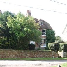
Church Farmhouse
882 m
Chest Tomb And Headstone 1 To 3 Metres South Of Church Of St Matthew
876 m
Mill House
180 m
Chest Tomb And Headstone About 15 Metres South West Of Church Of St Matthew
876 m
Chest Tomb About 50 Metres South West Of Church Of St Matthew
869 m
Place Farmhouse
1.3 km
House 30 Metres West Of Stone Farmhouse
530 m
Headstone To Richard Jervis, About 10 Metres South West Of Church Of St Matthew
874 m
The Leacon
285 m
Leacon Farmhouse
176 m
Chest Tomb To Hodges Family, About 15 Metres South Of Church Of St Matthew
884 m
Churchfield Terrace
761 m
Oasthouse About 25 Metres North West Of Burr Farmhouse
899 m
1-4, the Green
782 m
Pilgrims Cottages
796 m
Burr Farmhouse
921 m
Tinton
787 m
High House Farmhouse
1.2 km
Mountfield
742 m
Chest Tomb To Hodges Family, About 2 Metres South Of Church Of St Matthew
879 m
Two Headstones To Down Family About 20 Metres South West Of Church Of St Matthew
877 m
Stone Farmhouse
516 mAvis
Vous avez visité ce lieu ? Touchez les étoiles pour le noter et partager votre expérience ou vos photos avec la communauté ! Essayez maintenant ! Vous pouvez annuler à tout moment.
Trouvez des trésors cachés à chaque coin de rue !
Des petits cafés pittoresques aux points de vue planqués, fuyez la foule et dénichez les lieux qui vous ressemblent vraiment. Notre app vous facilite la vie : recherche vocale, filtres malins, itinéraires optimisés et bons plans partagés par des voyageurs du monde entier. Téléchargez vite pour vivre l'aventure en version mobile !

Une approche inédite de la découverte touristique❞
— Le Figaro
Tous les lieux qui valent la peine d'être explorés❞
— France Info
Une excursion sur mesure en quelques clics❞
— 20 Minutes