Highfields, building in Didmarton, Cotswold, Gloucestershire, UK
Emplacement : Didmarton
Coordonnées GPS : 51.58802,-2.26212
Dernière mise à jour : 18 novembre 2025 à 10:03
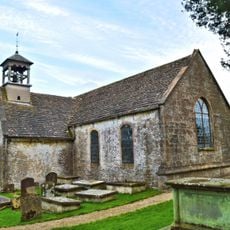
Church of St Lawrence
400 m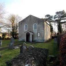
Congregational Church
139 m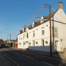
The Kings Arms
290 m
19, Chapel Walk
221 m
Springfield Cottage
35 m
Kingsmead House
355 m
Churchyard cross in St Lawrence's churchyard
398 m
The Manor House And Former Coach House And Stable Adjoining On West
384 m
K6 Telephone Kiosk, The Street
294 m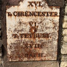
Milestone Set Into Wall, About 9 Metres West Of Number 34
291 m
West End House
313 m
47, The Street
324 m
43 And 45, The Street
320 m
Didmarton House And Railings To Front
303 m
Unidentified Monument, About 3 Metres North Of North Transept In Churchyard Of Church Of St Lawrence
400 m
Stable Block At The Kings Arms
289 m
Gazebo At Kingsmead House
373 m
Church of St Michael and All Angels
357 m
37, The Street
300 m
Reading Room
290 m
29 And 31, The Street
307 m
St Lawrence's Well With Adjacent Drinking Trough And Pump, In Front Of Kingsmead House
390 m
Number 1 Chapel Walk And Adjoining Railings
293 m
Townend Farmhouse
396 m
Whitehouse Farmhouse
344 m
14 And 16, The Street
329 m
The Old Rectory
337 m
Didmarton War Memorial
398 mAvis
Vous avez visité ce lieu ? Touchez les étoiles pour le noter et partager votre expérience ou vos photos avec la communauté ! Essayez maintenant ! Vous pouvez annuler à tout moment.
Trouvez des trésors cachés à chaque coin de rue !
Des petits cafés pittoresques aux points de vue planqués, fuyez la foule et dénichez les lieux qui vous ressemblent vraiment. Notre app vous facilite la vie : recherche vocale, filtres malins, itinéraires optimisés et bons plans partagés par des voyageurs du monde entier. Téléchargez vite pour vivre l'aventure en version mobile !

Une approche inédite de la découverte touristique❞
— Le Figaro
Tous les lieux qui valent la peine d'être explorés❞
— France Info
Une excursion sur mesure en quelques clics❞
— 20 Minutes