Lower Clayhill, architectural structure in Ringmer, Lewes, East Sussex, UK
Emplacement : Ringmer
Coordonnées GPS : 50.91178,0.05298
Dernière mise à jour : 20 novembre 2025 à 14:50
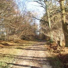
Plashett Park Wood
2 km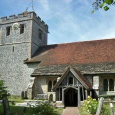
The Parish Church of St Mary the Virgin
2 km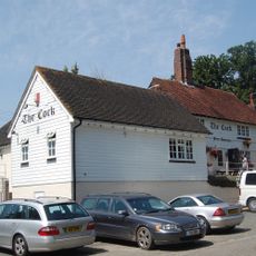
The Cock Inn
962 m
Barn To South West Of Half Yard Farmhouse
2 km
Hayes Farmhouse
1.4 km
Medieval ringwork at Clay Hill
513 m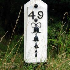
Milepost, Uckfield Road, Upper Wellingham
1.9 km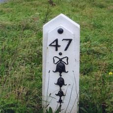
Milepost, jct with Isfield Road, N of the Old Ship PH
1.2 km
The Garden Wall And Gate Piers Of Wellingham House To The East Of The House
1.8 km
Park Gate And Attached Wall To The North West And South East
1.7 km
The Gazebo At Wellingham House To The South West Of The House
1.9 km
Barn At Upper Clayhill Farm To The West Of The House
495 m
Holly Tree Cottage
1.3 km
Upper Clayhill Farmhouse
490 m
Wellingham House
1.8 km
South Norlington House
1.8 km
Cheyney Charity Almshouses
2 km
Wellingham Cottages
1.3 km
Lilac Cottage
1.2 km
The Old Ship Inn
1.1 km
Wellingham Farmhouse
1.8 km
Norlington Gate
1.1 km
The Chestnuts
2 km
The Old Farmhouse
1.7 km
Barcombe House
1.1 km
Mill Cottage Pike Cottage
1.4 km
The Small House
1.9 km
The Village Well House And Pump On The Green
2 kmAvis
Vous avez visité ce lieu ? Touchez les étoiles pour le noter et partager votre expérience ou vos photos avec la communauté ! Essayez maintenant ! Vous pouvez annuler à tout moment.
Trouvez des trésors cachés à chaque coin de rue !
Des petits cafés pittoresques aux points de vue planqués, fuyez la foule et dénichez les lieux qui vous ressemblent vraiment. Notre app vous facilite la vie : recherche vocale, filtres malins, itinéraires optimisés et bons plans partagés par des voyageurs du monde entier. Téléchargez vite pour vivre l'aventure en version mobile !

Une approche inédite de la découverte touristique❞
— Le Figaro
Tous les lieux qui valent la peine d'être explorés❞
— France Info
Une excursion sur mesure en quelques clics❞
— 20 Minutes