
Boundary Stone At Ngr Ny 95185449, boundary marker in Blanchland, Northumberland, UK
Emplacement : Blanchland
Fait partie de : political border
Coordonnées GPS : 54.88519,-2.07664
Dernière mise à jour : 16 novembre 2025 à 09:55
Farmbuildings 20 Metres North Of Park House Farmhouse
3.1 km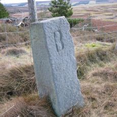
Boundary Stone At Ngr Ny 97255421
2.1 km
Boundary Stone At Ngr Ny 94045475
1.2 km
Boundary Stone At Ngr Ny 93945483, Outside Fence Corner
1.3 km
Boundary Stone At Ngr Ny 94305430
884 m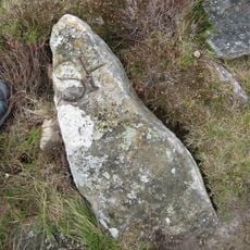
Boundary Stone At Ngr Ny 94125463, On West Of Fence
1.1 km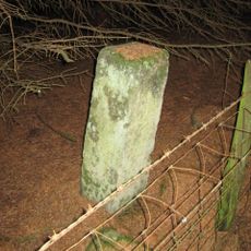
Boundary Stone At Ngr Ny 97305443
2.1 km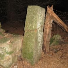
Boundary Stone At Ngr Ny 97365466
2.2 km
Park House Farmhouse And Adjacent Outbuilding
3.1 km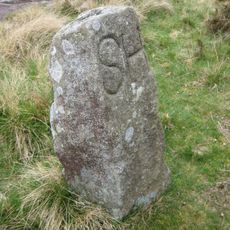
Boundary Stone At Ngr Ny 94005482
1.2 km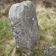
Boundary Stone At Ngr Ny 94165455, On West Of Fence
1 km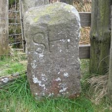
Boundary Stone At Ngr Ny 94515394, Just Within Fence Corner
863 m
Prehistoric hut circle settlement, farmstead and field system, 425m east of Burntshield Haugh
2.7 km
Low Rawgreen Farmhouse And Attached Bastle House, And Barn
3.2 km
Hut circle settlement and field system, Romano-British settlement, hush and lead ore works, 750m north east of Burntshield Haugh
2.6 km
Cairnfield 730m south east of Burntshield Haugh
2.8 km
Boundary Stone At Ngr Ny 95415487, 8 Metres South Of C20 Gate
432 m
Garden Wall To West Of Dukesfield Hall
3 km
Yard And Forecourt Walls To Holly Hill Cottage
2.5 km
Boundary Stone At Ngr Ny 94985435, Between Parallel Fences
246 m
Outbuilding To East Of The Hall
3 km
Bridge Over Dukesfield Cleugh 60 Metres South Of Hall
3 km
Pennypie Farmhouse And Adjacent Farmbuildings
2.7 km
The Old Granary And Attached Wall, 40 Metres South-East Of The Hall
3 km
Holly Hill Cottage And Adjacent Outbuilding
2.5 km
The Hall
3 km
Ladycross Quarry Nature Reserve
648 m
Raptor watchpoint
548 mAvis
Vous avez visité ce lieu ? Touchez les étoiles pour le noter et partager votre expérience ou vos photos avec la communauté ! Essayez maintenant ! Vous pouvez annuler à tout moment.
Trouvez des trésors cachés à chaque coin de rue !
Des petits cafés pittoresques aux points de vue planqués, fuyez la foule et dénichez les lieux qui vous ressemblent vraiment. Notre app vous facilite la vie : recherche vocale, filtres malins, itinéraires optimisés et bons plans partagés par des voyageurs du monde entier. Téléchargez vite pour vivre l'aventure en version mobile !

Une approche inédite de la découverte touristique❞
— Le Figaro
Tous les lieux qui valent la peine d'être explorés❞
— France Info
Une excursion sur mesure en quelques clics❞
— 20 Minutes