
Group of salterns and a possible moat 250m east of Bramber Castle
Group of salterns and a possible moat 250m east of Bramber Castle, archaeological site in Bramber, Horsham, England, UK
Emplacement : Bramber
Coordonnées GPS : 50.88420,-0.31262
Dernière mise à jour : 19 novembre 2025 à 22:40
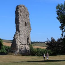
Château de Bramber
245 m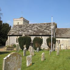
The Parish Church of St Peter
611 m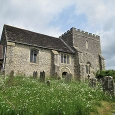
The Parish Church of St Nicholas
238 m
Beam Ends Hope Cottage
487 m
The Kings Head Inn
564 m
The Bridge Inn
470 m
Kings Barn Old Cottages
712 m
The Old Priory
169 m
Yew Tree Cottage
149 m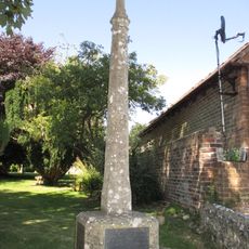
Upper Beeding War Memorial
590 m
1725 Cottages (Antiques)
718 m
The Priory
621 m
Burletts
587 m
Old Tiled Cottage Starlings
669 m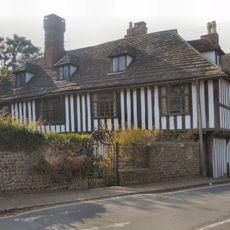
St Mary's House
209 m
The Garden Wall Of Pond Farmhouse To The East Of The House
647 m
Saltern in Saltings Field, 220m north of Beeding Bridge
415 m
Manor Cottage
557 m
Ferndale Glendale
527 m
Barn Belonging To The King's Head Inn To The West Of Pond Farmhouse
586 m
The Dilly
673 m
Cherry Tree Cottage Tall Chimneys
701 m
Maudlin Farm Cottage
599 m
The Manor House The Manor House Pharmacy
548 m
Holly Cottage
716 m
Candytuft
690 m
F H Lucas And Son Grocer Spinners
504 m
Pond Farmhouse
622 mAvis
Vous avez visité ce lieu ? Touchez les étoiles pour le noter et partager votre expérience ou vos photos avec la communauté ! Essayez maintenant ! Vous pouvez annuler à tout moment.
Trouvez des trésors cachés à chaque coin de rue !
Des petits cafés pittoresques aux points de vue planqués, fuyez la foule et dénichez les lieux qui vous ressemblent vraiment. Notre app vous facilite la vie : recherche vocale, filtres malins, itinéraires optimisés et bons plans partagés par des voyageurs du monde entier. Téléchargez vite pour vivre l'aventure en version mobile !

Une approche inédite de la découverte touristique❞
— Le Figaro
Tous les lieux qui valent la peine d'être explorés❞
— France Info
Une excursion sur mesure en quelques clics❞
— 20 Minutes