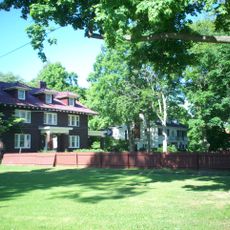
Rootstown Township, établissement humain, comté de Portage, Ohio, États-Unis
Emplacement : Portage County
Altitude : 325 m
Site web : http://rootstowntwp.com
Coordonnées GPS : 41.11056,-81.24222
Dernière mise à jour : 3 mars 2025 à 01:17
Dix Stadium
6.8 km
Partially Buried Woodshed
8.9 km
West Branch State Park
11.8 km
Quail Hollow State Park
15.8 km
Masonic Temple
11.2 km
Kent Stage
10.7 km
Memorial Stadium
9.5 km
Triangle Lake Bog State Nature Preserve
1.5 km
Kent Industrial District
11 km
Wills Gymnasium
10 km
Rockwell Field
6.8 km
Kent Free Library
11.1 km
Atwater Congregational Church
12.6 km
Tom S. Cooperrider-Kent Bog State Nature Preserve
9.6 km
Aaron Ferrey House
10.5 km
John Davey House
11.6 km
Charles Kent House
11.4 km
Freedom Congregational Church
16 km
Francis D. Alling House
15.7 km
Franklin Township Hall
11.1 km
West Main Street District
11.4 km
Ohio State Normal College At Kent
10 km
Kent State University Center for the Performing Arts
9.5 km
May 4, 1970, Kent State Shootings Site
9.6 km
Old Stagecoach Inn
16.1 km
West Main Street Historic District
11.2 km
Mogadore
14.4 km
Wingfoot Lake State Park
14.4 kmAvis
Vous avez visité ce lieu ? Touchez les étoiles pour le noter et partager votre expérience ou vos photos avec la communauté ! Essayez maintenant ! Vous pouvez annuler à tout moment.
Trouvez des trésors cachés à chaque coin de rue !
Des petits cafés pittoresques aux points de vue planqués, fuyez la foule et dénichez les lieux qui vous ressemblent vraiment. Notre app vous facilite la vie : recherche vocale, filtres malins, itinéraires optimisés et bons plans partagés par des voyageurs du monde entier. Téléchargez vite pour vivre l'aventure en version mobile !
Une approche inédite de la découverte touristique❞
— Le Figaro
Tous les lieux qui valent la peine d'être explorés❞
— France Info
Une excursion sur mesure en quelques clics❞
— 20 Minutes