
Poblacion, barangay of the Philippines in the municipality of San Juan, Batangas
Emplacement : San Juan
Coordonnées GPS : 13.82685,121.39356
Dernière mise à jour : 14 avril 2025 à 23:06
San Cristobal
26.7 km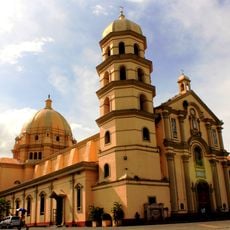
Lipa Cathedral
28 km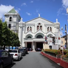
Lucena Cathedral
26.6 km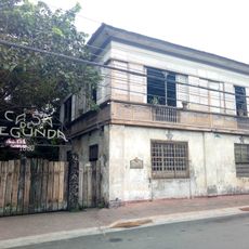
Casa de Segunda
28 km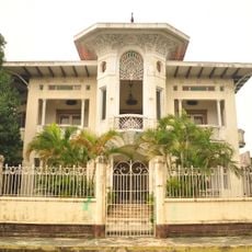
Gala–Rodriguez House
20.7 km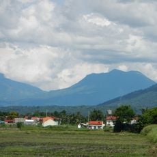
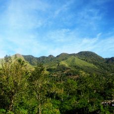
Mounts Banahaw–San Cristobal Protected Landscape
27.1 km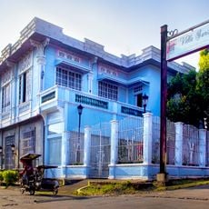
Don Catalino Rodriguez Ancestral House
20.8 km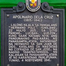
Apolinario dela Cruz historical marker
24 km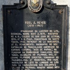
Fidel A. Reyes historical marker
27.9 km
Villa Escudero Museum
19.6 km
Cocoons (at Club Laiya)
17.1 km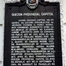
Quezon Provincial Capitol historical marker
26.3 km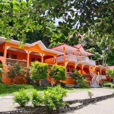
Pipisik Beach Resort
18.8 km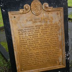
Claro Recto y Mayo historical marker
16.5 km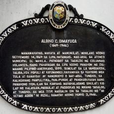
Albino C. Dimayuga historical marker
27.9 km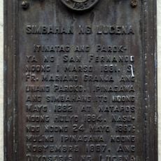
Church of Lucena historical marker
26.6 km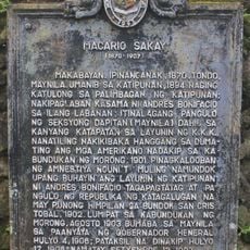
Macario Sakay historical marker
23.4 km
Algo Hotel and Resort
22.9 km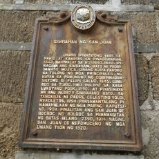
Church of San Juan historical marker
205 m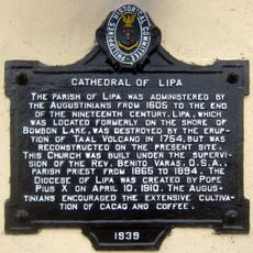
Cathedral of Lipa historical marker
27.9 km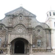
Saint John Nepomucene Parish Church
225 m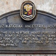
Luz–Katigbak Ancestral House historical marker
28 km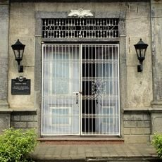
Rodriguez House historical marker
20.8 km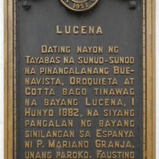
Lucena historical marker
26.6 km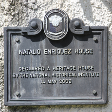
Natalio Enriquez House historical marker
20.8 km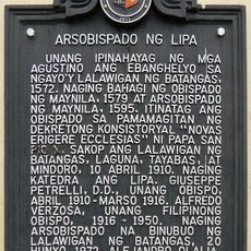
Archbishopric of Lipa historical marker
27.9 km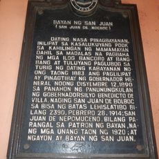
Town of San Juan historical marker
385 m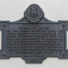
Church of Sariaya historical marker
20.7 kmAvis
Vous avez visité ce lieu ? Touchez les étoiles pour le noter et partager votre expérience ou vos photos avec la communauté ! Essayez maintenant ! Vous pouvez annuler à tout moment.
Trouvez des trésors cachés à chaque coin de rue !
Des petits cafés pittoresques aux points de vue planqués, fuyez la foule et dénichez les lieux qui vous ressemblent vraiment. Notre app vous facilite la vie : recherche vocale, filtres malins, itinéraires optimisés et bons plans partagés par des voyageurs du monde entier. Téléchargez vite pour vivre l'aventure en version mobile !

Une approche inédite de la découverte touristique❞
— Le Figaro
Tous les lieux qui valent la peine d'être explorés❞
— France Info
Une excursion sur mesure en quelques clics❞
— 20 Minutes