
Batuan, municipality of the Philippines in the province of Masbate
Emplacement : Masbate
Création : 1951
Altitude : 31 m
Partage une frontière avec : Mobo, San Vicente
Coordonnées GPS : 12.42222,123.78167
Dernière mise à jour : 2 avril 2025 à 15:20
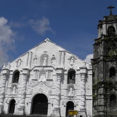
Daraga Church
81.4 km
Capul Church
43.6 km
Bulusan Volcano Natural Park
48.5 km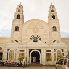
Sorsogon Cathedral
65.5 km
Phare de Capul
39.7 km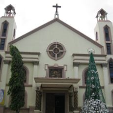
Masbate Cathedral
18.7 km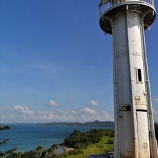
Phare de Bagatao
45.7 km
Magasang Rock Formation
70.7 km
The Forts of Bulusan historical marker
53.3 km
Church of Capul historical marker
43.6 km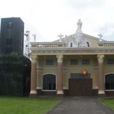
Bacon Church
74.1 km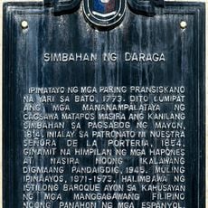
Church of Daraga historical marker
81.4 km
Bituon Beach Resort
15.6 km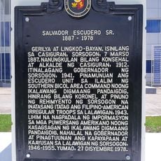
Salvador Escudero Sr. historical marker
65.8 km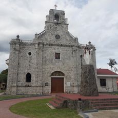
Barcelona Church
63.2 km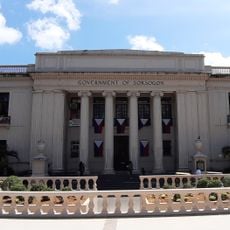
Sorsogon Provincial Capitol
65.7 km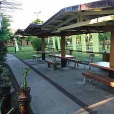
La Edley
81.7 km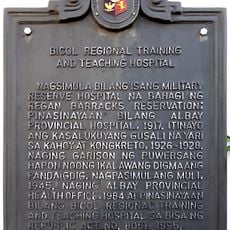
Bicol Regional Training and Teaching Hospital historical marker
80.9 km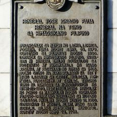
General Jose Ignacio Paua historical marker
80.1 km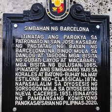
Church of Barcelona historical marker
63.2 km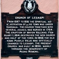
Church of Legaspi historical marker
80.9 km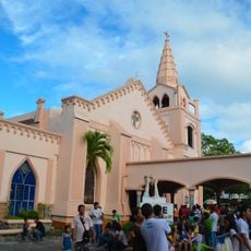
Legazpi Church
81 km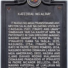
Cathedral of Albay historical marker
79.9 km
Capul Lighthouse historical marker
39.6 km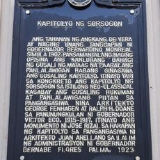
Capitol of Sorsogon historical marker
65.7 km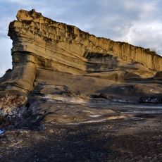
Magsapad Rock Formation
70.8 km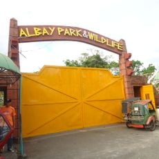
Albay Park and Wildlife
82 km
Caranas Rock Formation
71.8 kmVous avez visité ce lieu ? Touchez les étoiles pour le noter et partager votre expérience ou vos photos avec la communauté ! Essayez maintenant ! Vous pouvez annuler à tout moment.
Trouvez des trésors cachés à chaque coin de rue !
Des petits cafés pittoresques aux points de vue planqués, fuyez la foule et dénichez les lieux qui vous ressemblent vraiment. Notre app vous facilite la vie : recherche vocale, filtres malins, itinéraires optimisés et bons plans partagés par des voyageurs du monde entier. Téléchargez vite pour vivre l'aventure en version mobile !

Une approche inédite de la découverte touristique❞
— Le Figaro
Tous les lieux qui valent la peine d'être explorés❞
— France Info
Une excursion sur mesure en quelques clics❞
— 20 Minutes