
Banga, municipality of the Philippines in the province of South Cotabato
Emplacement : South Cotabato
Altitude : 169 m
Partage une frontière avec : Norala
Site web : http://bangascot.gov.ph
Coordonnées GPS : 6.30000,124.78333
Dernière mise à jour : 7 mars 2025 à 04:57
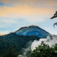
Mont Apo
93.6 km
Mont Matutum
33.1 km
Sultan Haji Hassanal Bolkiah Mosque
121.4 km
Parlement du Bangsamoro
116.1 km
Fort Pikit
85.5 km
Bangsamoro Government Center
116.2 km
Kutawato Caves
118.6 km
Cotabato Regional and Medical Center
117 km
Tantawan Park
118.6 km
Mount Apo Natural Park
95.1 km
Pacman Beach Resort Complex
55 km
Tamontaka Church
116.3 km
Fuerte de Reina Regente
85.7 km
Burial Site of the Seventeen Filipino Martyrs of Koronadal historical marker
22.9 km
Sultan Dipatuan Kudarat historical marker
118.5 km
Mont Parker
23.8 km
Immaculate Conception Church of Tamontaka historical marker
116.3 km
Gen. Paulino Santos historical marker
47.8 km
Andres Bonifacio historical marker
112.4 km
Ohta Kyozaburo historical marker
118.7 km
Notre Dame Archdiocesan Seminary historical marker
120.4 km
Museyo Kutawato
87.3 km
KCC Cinema
23.6 km
Koronadal Cathedral
23 km
Wasag Beach
69.3 km
Talisay Beach
96.2 km
Poral Tibpuan Beach
87.6 km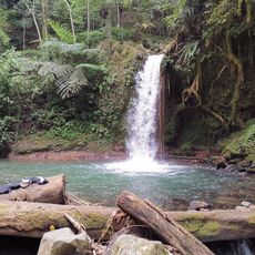
Balnunto Falls
47.4 kmVous avez visité ce lieu ? Touchez les étoiles pour le noter et partager votre expérience ou vos photos avec la communauté ! Essayez maintenant ! Vous pouvez annuler à tout moment.
Trouvez des trésors cachés à chaque coin de rue !
Des petits cafés pittoresques aux points de vue planqués, fuyez la foule et dénichez les lieux qui vous ressemblent vraiment. Notre app vous facilite la vie : recherche vocale, filtres malins, itinéraires optimisés et bons plans partagés par des voyageurs du monde entier. Téléchargez vite pour vivre l'aventure en version mobile !

Une approche inédite de la découverte touristique❞
— Le Figaro
Tous les lieux qui valent la peine d'être explorés❞
— France Info
Une excursion sur mesure en quelques clics❞
— 20 Minutes