Cow Bay Beach, beach in Nova Scotia, Canada
Emplacement : Nova Scotia
Coordonnées GPS : 44.61685,-63.43199
Dernière mise à jour : 9 novembre 2025 à 13:32
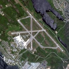
Base des Forces canadiennes Shearwater
6 km
Shearwater Aviation Museum
6.6 km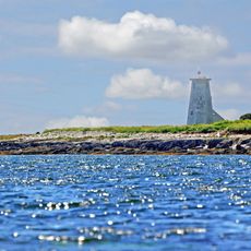
Devils Island Light
4.5 km
Lawrencetown Beach Provincial Park
8.1 km
Conrods and Lawrencetown Beach
7.7 km
MacCormacks Beach
4.9 km
Parc provincial Cole Harbour-Lawrencetown
5.5 km
Maugher Beach
8.1 km
Rainbow Haven Beach Provincial Park
3.4 km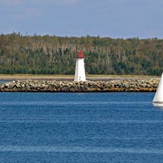
Maugher Beach lighthouse
8.2 km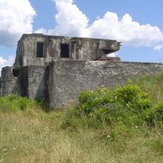
Fort McNab
7 km
Lawrencetown Beach
8.7 km
Noonans Beach
3.3 km
Conrod Island Provincial Park
5.1 km
Parc provincial McNabs and Lawlor Islands
6.7 km
Conrod Island Park Reserve
6.1 km
Rainbow Haven Beach
3.9 km
Kiwanis Centre Beach
5.1 km
Lawrencetown Beach
8.2 km
Silver Sands Beach
713 m
Hartlen Point Forces Golf Club
2.4 km
Maugers Beach
7.6 km
Hangmans Beach
7.5 km
Abenaki Canoe Club Beach
8.6 km
10-inch 32-ton Mk. I Breechloading Gun (Serial No. 5)
6.8 km
6-inch Mk VII Breechloading Gun (Serial No. l346), mounted on a Central Pivot Mk II, VS&M, 1900, previously in a gun emplacement at Fort Ogilvie in Point Pleasant Park
6.9 km
Canon
8.6 km
Canon
8.6 kmAvis
Vous avez visité ce lieu ? Touchez les étoiles pour le noter et partager votre expérience ou vos photos avec la communauté ! Essayez maintenant ! Vous pouvez annuler à tout moment.
Trouvez des trésors cachés à chaque coin de rue !
Des petits cafés pittoresques aux points de vue planqués, fuyez la foule et dénichez les lieux qui vous ressemblent vraiment. Notre app vous facilite la vie : recherche vocale, filtres malins, itinéraires optimisés et bons plans partagés par des voyageurs du monde entier. Téléchargez vite pour vivre l'aventure en version mobile !

Une approche inédite de la découverte touristique❞
— Le Figaro
Tous les lieux qui valent la peine d'être explorés❞
— France Info
Une excursion sur mesure en quelques clics❞
— 20 Minutes