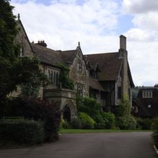
Abbaye de Storrington
2.3 km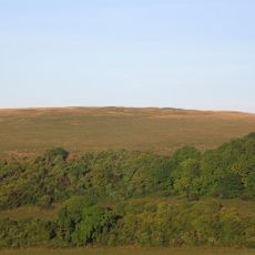
Prehistoric flint mine and a Martin Down style enclosure on Harrow hill, 850m south east of Lee Farm
2.3 km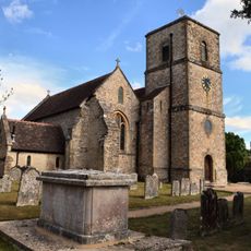
The Parish Church of St Mary the Virgin
2.4 km
Church of St Peter, Parham
2.4 km
Pair of platform barrows on the western side of Kithurst Hill car park: part of a dispersed round barrow cemetery on Kithurst Hi
520 m
Rising Sun Cottage
2.5 km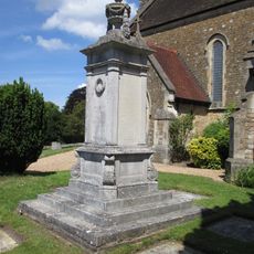
Storrington War Memorial
2.4 km
Ladye Place
2.5 km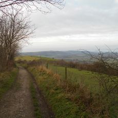
Rackham Banks: A cross dyke and Itford Hill style settlement on Rackham Hill, 900m SSE of Oldbottom Barn
2.2 km
Linear group of three bowl barrows immediately east of Kithurst Hill car park: part of a dispersed round barrow cemetery on Kith
402 m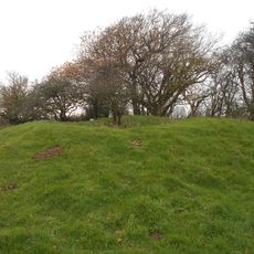
Bowl barrow on Springhead Hill, 750m SSW of Springhead Farm
1.4 km
Bowl barrow at Kithurst Hill car park: part of a dispersed round barrow cemetery on Kithurst Hill
444 m
Group of four bowl barrows at the Chantry Post
1.5 km
Bowl barrow 950m south west of Grey Friars Farm: part of a dispersed round barrow cemetery on Kithurst Hill
609 m
Cross dyke on Chantry Hill, 470m south of Grey Friars Farm
1.3 km
Group of six bowl barrows 790m south west of Grey Friars Farm: part of a dispersed round barrow cemetery on Kithurst Hill
770 m
Prehistoric linear boundary on Wepham Down
2.4 km
An unenclosed Iron Age urnfield and associated remains on Rackham Hill, 900m SSE of Rackham Farm
2 km
Cross dyke on Springhead Hill, 780m south of Springhead Farm
1.2 km
Rod Cottage
2.2 km
Waterfall Cottage
2.2 km
Cootham House
2 km
Cobb Court
2.2 km
The Horsecroft
2.4 km
St Josephs Hall
2.1 km
Pair Of Cottages And Attached Wall At St Joseph's Hall
2.1 km
Abbey Convent
2.3 km
Springhead Farmhouse
1.7 kmAvis
Vous avez visité ce lieu ? Touchez les étoiles pour le noter et partager votre expérience ou vos photos avec la communauté ! Essayez maintenant ! Vous pouvez annuler à tout moment.
Trouvez des trésors cachés à chaque coin de rue !
Des petits cafés pittoresques aux points de vue planqués, fuyez la foule et dénichez les lieux qui vous ressemblent vraiment. Notre app vous facilite la vie : recherche vocale, filtres malins, itinéraires optimisés et bons plans partagés par des voyageurs du monde entier. Téléchargez vite pour vivre l'aventure en version mobile !

Une approche inédite de la découverte touristique❞
— Le Figaro
Tous les lieux qui valent la peine d'être explorés❞
— France Info
Une excursion sur mesure en quelques clics❞
— 20 Minutes