Marine sanctuary
Emplacement : Eastern Samar
Coordonnées GPS : 10.93861,125.76927
Dernière mise à jour : 14 novembre 2025 à 22:05
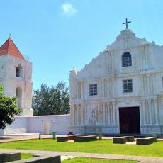
Guiuan Church
11.5 km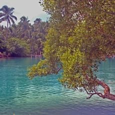
Guiuan Protected Landscape and Seascape
7.9 km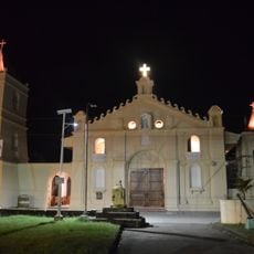
Balangiga Church
46.1 km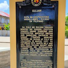
Suluan quincentennial historical marker
27.9 km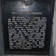
Balangiga Massacre historical marker
46 km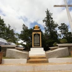
Homonhon quincentennial historical marker
27.3 km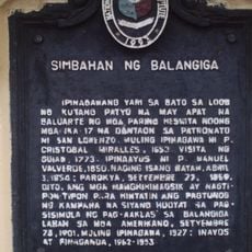
Church of Balangiga historical marker
46 km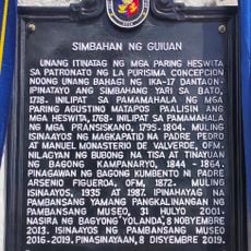
Church of Guiuan historical marker
11.5 km
United Nations Evacuation Center historical marker
14.2 km
Samar quincentennial historical marker
6.4 km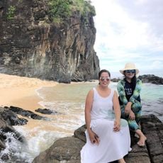
Handig Beach
15.1 km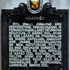
Homonhon historical marker
27.4 km
Linao Cave
6.5 km
Buro-Buro
10.2 km
Canhugas Nature Park
46.1 km
Marine Sanctuary
3.8 km
Guiuan Cultural Stage
11.3 km
Dumpao Beach
12.1 km
Sapao Beach
11.3 km
Calicoan View
7.1 km
Panglaw-beach
47 km
Dako Bato Beach
46.8 km
Panay Beach and Hernani Natural Pools
43.8 km
Magellan First Landing
27.5 km
Monument
6.2 km
Jose Rizal Monument
11.4 km
Three Bells of Balangiga
46 km
Valeriano Abanador Statue
46 kmVous avez visité ce lieu ? Touchez les étoiles pour le noter et partager votre expérience ou vos photos avec la communauté ! Essayez maintenant ! Vous pouvez annuler à tout moment.
Trouvez des trésors cachés à chaque coin de rue !
Des petits cafés pittoresques aux points de vue planqués, fuyez la foule et dénichez les lieux qui vous ressemblent vraiment. Notre app vous facilite la vie : recherche vocale, filtres malins, itinéraires optimisés et bons plans partagés par des voyageurs du monde entier. Téléchargez vite pour vivre l'aventure en version mobile !

Une approche inédite de la découverte touristique❞
— Le Figaro
Tous les lieux qui valent la peine d'être explorés❞
— France Info
Une excursion sur mesure en quelques clics❞
— 20 Minutes