Manor House, house in Cherhill, Wiltshire, UK
Emplacement : Cherhill
Coordonnées GPS : 51.44433,-1.90794
Dernière mise à jour : 16 novembre 2025 à 10:50
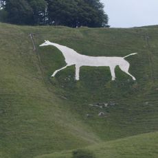
Cherhill White Horse
2.6 km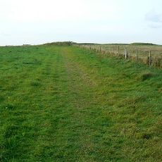
Windmill Hill
2.5 km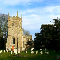
Church of All Saints
266 m
Saucer barrow 250m east of Windmill Hill: part of the Windmill Hill round barrow cemetery
2.7 km
Pair of round barrows 200m SSE of Windmill Hill: part of the Windmill Hill round barrow cemetery.
2.5 km
A causewayed enclosure, the core of a round barrow cemetery, part of a prehistoric field system and an associated mortuary enclo
2.2 km
Bowl barrow 200m south of Windmill Hill: part of the Windmill Hill round barrow cemetery.
2.3 km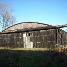
Two Former Hangars On North Side Of Former Airfield
1.3 km
The Manor House
207 m
Bowl barrow 200m east of Windmill Hill: part of the Windmill Hill round barrow cemetery.
2.6 km
Pair of bowl barrows on West Down, 550m east of Witch Plantation
2.7 km
Tudor Thatch
161 m
Nolands Farmhouse
942 m
Upper Farmhouse
2.8 km
Bowl barrow 350m north-east of White Horse Plantation
2.1 km
Pair of round barrows and section of linear earthwork NE of the gallops on West Down
2.6 km
Cross dyke 520m north east of Cherhill Monument
2.5 km
Horslip long barrow, 450m north-west of Horslip Bridge.
2.4 km
Former Hangar At North East Corner Of Former Airfield
845 m
Bowl barrow 190m north east of Nolands Farm, Yatesbury
750 m
Combined Officers Mess And Offices, Yatesbury Airfield
1.5 km
Two bowl barrows 320m south-east of Little London
907 m
Bowl barrow 400m west of Cooks Plantation
2.1 km
Linear boundary earthwork and associated field system on Cherhill Down
2.1 km
The Old Rectory
696 m
Three Monuments In Churchyard South Of Chancel Of Church Of All Saints
268 m
Granary At Manor Farm
144 m
Yatesbury House Farmhouse
424 mVous avez visité ce lieu ? Touchez les étoiles pour le noter et partager votre expérience ou vos photos avec la communauté ! Essayez maintenant ! Vous pouvez annuler à tout moment.
Trouvez des trésors cachés à chaque coin de rue !
Des petits cafés pittoresques aux points de vue planqués, fuyez la foule et dénichez les lieux qui vous ressemblent vraiment. Notre app vous facilite la vie : recherche vocale, filtres malins, itinéraires optimisés et bons plans partagés par des voyageurs du monde entier. Téléchargez vite pour vivre l'aventure en version mobile !

Une approche inédite de la découverte touristique❞
— Le Figaro
Tous les lieux qui valent la peine d'être explorés❞
— France Info
Une excursion sur mesure en quelques clics❞
— 20 Minutes