
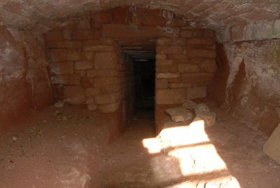
Ice house approximately 75 metres south west of Burton Manor
Ice house approximately 75 metres south west of Burton Manor, ice house in Burton, near Neston, Cheshire, UK
Emplacement : Cheshire West and Chester
Coordonnées GPS : 53.25906,-3.02984
Dernière mise à jour : 5 mars 2025 à 01:33
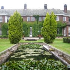
Burton Manor
108 m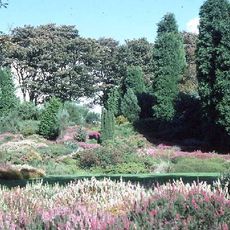
Ness Botanic Gardens
1.7 km
St Michael's Church, Shotwick
3.2 km
Shotwick Hall
3.1 km
Burton Point
1.2 km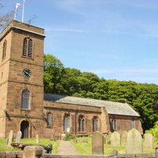
St Nicholas' Church, Burton
436 m
Bishop Wilson's House
162 m
Front garden walls and gatepiers at Shotwick Hall
3.1 km
Tombchest of Robert and Martha Ellison, 10 metres southwest of south corner of tower of Church of St Michael
3.2 km
Rake Farm Cottage
163 m
Tombchest of John Nevett Bennett, 5 metres west of south porch of St Michael's Church
3.2 km
Footpath Guidepost At Junction Of Pipers Lane Opposite The White House
1.5 km
Barn End
206 m
Sundial in the churchyard of St Michael
3.2 km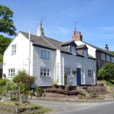
Plessington Cottage
361 m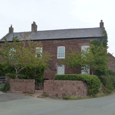
Laburnam Farmhouse And Garden Walls Attached At Front
2.3 km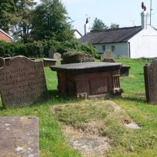
Group of 18 chest tombs, approximately 2 metres from the southeast corner of Church of St Nicholas
432 m
Tombchest of James Phillips, 2 metres south of the sundial in the Churchyard of St Michael
3.2 km
Former kitchen or bakehouse attached to north east corner of Shotwick Hall
3.1 km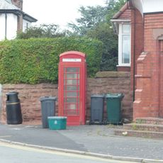
K6 Telephone Kiosk In Forecourt Of Post Office (Post Office Not Included)
2.3 km
Tombchest of Rev M Reay and 4 children, 8 metres south of south porch of Church of St Michael
3.2 km
L-shaped ranges of farm buildings 60 metres north of Shotwick Hall
3 km
Tombchest of William Briscoe (died 1723) and others, 4 metres west of priest's door to St Michael's Church
3.2 km
Vicarage Farmhouse
3.2 km
Tombchest of William Briscoe (died 1704) and others, 5 metres southwest of priest's door to St Michael's Church
3.2 km
Footpath Guidepost 5 Metres North Of Top Lodge
1.8 km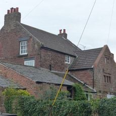
Goldstraw Farmhouse And Attached Farm Building To North West
2.2 km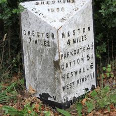
Milepost, S of Badgers Rake House
2.7 kmAvis
Vous avez visité ce lieu ? Touchez les étoiles pour le noter et partager votre expérience ou vos photos avec la communauté ! Essayez maintenant ! Vous pouvez annuler à tout moment.
Trouvez des trésors cachés à chaque coin de rue !
Des petits cafés pittoresques aux points de vue planqués, fuyez la foule et dénichez les lieux qui vous ressemblent vraiment. Notre app vous facilite la vie : recherche vocale, filtres malins, itinéraires optimisés et bons plans partagés par des voyageurs du monde entier. Téléchargez vite pour vivre l'aventure en version mobile !

Une approche inédite de la découverte touristique❞
— Le Figaro
Tous les lieux qui valent la peine d'être explorés❞
— France Info
Une excursion sur mesure en quelques clics❞
— 20 Minutes