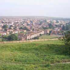
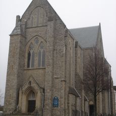
Moulsecoomb and Bevendean, electoral ward of the unitary authority of Brighton and Hove
Emplacement : Brighton and Hove
Coordonnées GPS : 50.84500,-0.11000
Dernière mise à jour : 6 mars 2025 à 21:27
Whitehawk Camp
2 km
Pepper Pot
2.2 km
Hollingbury Castle
1.5 km
Park Crescent
2.1 km
Whitehawk Hill
1.9 km
Moulsecoomb Place Halls
601 m
St Martin's Church, Brighton
1.9 km
Brighton Forum
2.2 km
St Joseph's Church, Brighton
1.9 km
Percy and Wagner Almshouses
2 km
Church of the Annunciation, Brighton
2.2 km
St Luke's Church, Queen's Park, Brighton
2.2 km
St Wilfrid's Church, Brighton
1.7 km
Bevendean Down
605 m
Brighton Extra Mural Cemetery Cemetery Chapel
1.2 km
Jewish Cemetery Chapel
1.7 km
Brighton And Preston Cemetery Mortuary Chapel
1.3 km
St Mary Magdalene
2.1 km
Woodvale Cemetery Tomb Of John Frederick Ginnett
1.1 km
Finsbury Road Board School
2.2 km
Hollingbury Library
2.2 km
Woodvale Cemetery North Lodge
1.3 km
Tram Shelter Opposite The Junction With Surrenden Road
1.9 km
St Lukes School
2.2 km
Woodvale Crematorium
1.2 km
Hodshrove Viaduct
756 m
Walls To Brighton Business Centre
2.2 km
Downs Junior School And Attached Walls And Gate Piers
1.8 kmVous avez visité ce lieu ? Touchez les étoiles pour le noter et partager votre expérience ou vos photos avec la communauté ! Essayez maintenant ! Vous pouvez annuler à tout moment.
Trouvez des trésors cachés à chaque coin de rue !
Des petits cafés pittoresques aux points de vue planqués, fuyez la foule et dénichez les lieux qui vous ressemblent vraiment. Notre app vous facilite la vie : recherche vocale, filtres malins, itinéraires optimisés et bons plans partagés par des voyageurs du monde entier. Téléchargez vite pour vivre l'aventure en version mobile !
Une approche inédite de la découverte touristique❞
— Le Figaro
Tous les lieux qui valent la peine d'être explorés❞
— France Info
Une excursion sur mesure en quelques clics❞
— 20 Minutes