
Oasthouse At Fant Farm To South Of Fant House, drying house in Maidstone, Kent, UK
Emplacement : Maidstone
Coordonnées GPS : 51.26253,0.49579
Dernière mise à jour : 22 novembre 2025 à 21:16
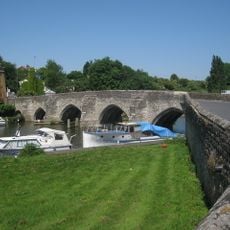
East Farleigh Bridge
1.2 km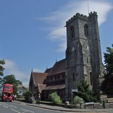
St Michael and All Angels Church, Maidstone
1.1 km
The White Lion Public House
1.2 km
Half Yoke House
875 m
Dean Farmhouse
1 km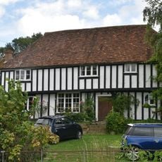
Bridge House
1.2 km
Bydews Place
629 m
310, Tonbridge Road
672 m
432-450, Tonbridge Road
930 m
Munsfield Oast
1.2 km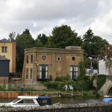
Former East Farleigh Waterworks
1.2 km
Wall To The North East Of Fant House
123 m
Queens House At Oakwood Hospital
1.1 km
St Andrew's House At Oakwood Hospital
1 km
Wall To South Of Oakwood Hospital
823 m
The Beeches At Oakwood Hospital
870 m
Bydews Farmhouse
631 m
Oasthouse At Bydews Farm To The South West Of The Former Granary
580 m
20 And 22, Upper Fant Road
1.1 km
Lodge To East Of St Andrew's House At Oakwood Hospital
960 m
Fant House
98 m
Bower Lodge
1.1 km
33, 35, 37 And 39, Upper Fant Road
1 km
Cottage To North West Of Bydews Place
625 m
Barn To The South Of Dean Farmhouse
1 km
Gate And Lodges Of Oakwood Hospital
925 m
Dovecote In The Grounds Of Bydews Place
650 m
Old Cottages
844 mAvis
Vous avez visité ce lieu ? Touchez les étoiles pour le noter et partager votre expérience ou vos photos avec la communauté ! Essayez maintenant ! Vous pouvez annuler à tout moment.
Trouvez des trésors cachés à chaque coin de rue !
Des petits cafés pittoresques aux points de vue planqués, fuyez la foule et dénichez les lieux qui vous ressemblent vraiment. Notre app vous facilite la vie : recherche vocale, filtres malins, itinéraires optimisés et bons plans partagés par des voyageurs du monde entier. Téléchargez vite pour vivre l'aventure en version mobile !

Une approche inédite de la découverte touristique❞
— Le Figaro
Tous les lieux qui valent la peine d'être explorés❞
— France Info
Une excursion sur mesure en quelques clics❞
— 20 Minutes