40-46, Chipstead Lane, building in Riverhead, Sevenoaks, Kent, UK
Emplacement : Riverhead
Coordonnées GPS : 51.28433,0.16732
Dernière mise à jour : 21 novembre 2025 à 02:07
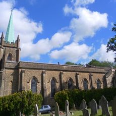
Church of St Mary
242 m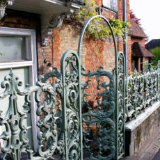
Forecourt Railings And Entrance Arch To The Manor House
150 m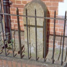
Milestone, Amherst Hill, Riverhead, nr jct with Worships Hill
239 m
Dovecot In Garden To West Of The Riverhead Public House
233 m
8, The Square
144 m
84 And 86, Chipstead Lane
125 m
The Old Farmhouse
61 m
1-4, Linden Square
243 m
7, Linden Square
240 m
3 And 5, Maidstone Road
207 m
7, The Square
152 m
The Manor House Nursing Home
143 m
Riverhead House
192 m
Wall To East And South Of Coach House Building
196 m
Wall To West Of The Riverhead Public House
252 m
Coach House To West Of No 2 Wall West Of No 2
113 m
48 And 50, Chipstead Lane
14 m
Piece Of Wall To South East Of Riverhead House
186 m
The Beehive Public House
35 m
Manor House Cottage
141 m
Cade House
138 m
Stable Building To Rear Of The Old Farmhouse
52 m
Forecourt Railings To Riverhead House
159 m
Wall Running South, West South West And South Again From North West Corner Of Lane Belonging To The Riverhead Public House
220 m
Durham House
98 m
52 And 54, Chipstead Lane
23 m
The Old Cottage
68 m
Old Outbuildings To North West Of The Riverhead Public House
209 mAvis
Vous avez visité ce lieu ? Touchez les étoiles pour le noter et partager votre expérience ou vos photos avec la communauté ! Essayez maintenant ! Vous pouvez annuler à tout moment.
Trouvez des trésors cachés à chaque coin de rue !
Des petits cafés pittoresques aux points de vue planqués, fuyez la foule et dénichez les lieux qui vous ressemblent vraiment. Notre app vous facilite la vie : recherche vocale, filtres malins, itinéraires optimisés et bons plans partagés par des voyageurs du monde entier. Téléchargez vite pour vivre l'aventure en version mobile !

Une approche inédite de la découverte touristique❞
— Le Figaro
Tous les lieux qui valent la peine d'être explorés❞
— France Info
Une excursion sur mesure en quelques clics❞
— 20 Minutes