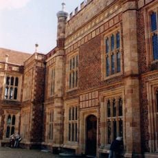
The Manor House, house in Woking, Surrey, UK
Emplacement : Woking
Coordonnées GPS : 51.27827,-0.55716
Dernière mise à jour : 22 novembre 2025 à 21:22
Sutton Place
823 m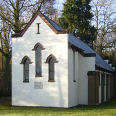
All Souls' Church, Sutton Green
723 m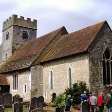
Church of St Mary
1.1 km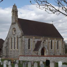
Church of St Edward the Confessor
476 m
Evelyn Tomb 30 Feet North Of North Wall Of Church Of St Mary
1.1 km
Bull Lane Cottages
199 m
Sendholme
1.2 km
Send Court Farm House
1.2 km
Barn 10 Yards North East Of Cox's Farm House
799 m
Disc barrow on Whitmoor Common
1.2 km
Sutton Place Including The Service Court Yard
843 m
Old Manor House (site of) W of Roman Catholic church, Sutton Park
505 m
Jones Tomb 60 Yards North West Of West Tower Of Church Of St Mary
1.1 km
Granary 15 Yards Soth West Of Whitmoor House
722 m
Oak House
388 m
The Old Cottage
768 m
Lower Westfield Farm House
1.1 km
Runtleywood Farm House
948 m
The Old Post Office
370 m
April Cottage September Cottage
343 m
Whitmoor House Including The Cottage To The Rear
700 m
Vine Cottage
445 m
Cox's Farm House
825 m
Garden Walls And Corner Pavilion To West Of Sutton Place
737 m
Quaves Hatch
488 m
Stable Block, 10 Yards West Of Sutton Place
780 m
Stable Block 20 Yards North Of Send Grove
1.2 km
Frog Lane Farm House
703 mAvis
Vous avez visité ce lieu ? Touchez les étoiles pour le noter et partager votre expérience ou vos photos avec la communauté ! Essayez maintenant ! Vous pouvez annuler à tout moment.
Trouvez des trésors cachés à chaque coin de rue !
Des petits cafés pittoresques aux points de vue planqués, fuyez la foule et dénichez les lieux qui vous ressemblent vraiment. Notre app vous facilite la vie : recherche vocale, filtres malins, itinéraires optimisés et bons plans partagés par des voyageurs du monde entier. Téléchargez vite pour vivre l'aventure en version mobile !

Une approche inédite de la découverte touristique❞
— Le Figaro
Tous les lieux qui valent la peine d'être explorés❞
— France Info
Une excursion sur mesure en quelques clics❞
— 20 Minutes