
The Former Schoolroom, architectural structure in Plumpton, Lewes, East Sussex, UK
Emplacement : Plumpton
Coordonnées GPS : 50.90470,-0.06118
Dernière mise à jour : 19 novembre 2025 à 12:22
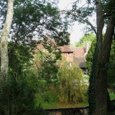
Plumpton Place
382 m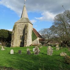
The Parish Church of St Michael and All Angels, Plumpton
741 m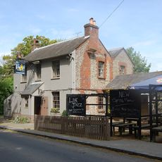
The Half Moon Inn
265 m
Warningore Farm Cottages
1.1 km
Upper Mill
1.3 km
Saucer barrow 170m SW of Ditchling Cross, Plumpton Plain
957 m
Oval barrow 775m south of Plumpton Place on Plumpton Plain
950 m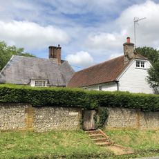
The Eugh
35 m
Bowl barrow 200m east of Plumpton Bostall (top end)
990 m
Two bowl barrows north-east of Streathill Farm
1.2 km
Bowl barrow north west of Warningore Bostall: part of Plumpton Plain round barrow cemetery
1.1 km
The Cottages And Gateway At Plumpton Place To West Of The House
454 m
Bowl barrow south west of The Beeches: part of Plumpton Plain round barrow cemetery
970 m
Bowl barrow south of The Beeches: part of Plumpton Plain round barrow cemetery
1 km
Two bowl barrows 600m south east of Ditchling Cross: part of Plumpton Plain round barrow cemetery
927 m
Part of Plumpton Plain round barrow cemetery and an Anglo-Saxon barrow field south east of Warningore Bostall
1.1 km
Cross dyke 730m south east of Ditchling Cross
949 m
Cross dyke and adjacent saucer barrow 850m south east of Ditchling Cross: part of Plumpton Plain round barrow cemetery
987 m
The Cottage
324 m
Bowl barrow 700m south east of Ditchling Cross: part of Plumpton Plain round barrow cemetery
960 m
The Mill House
306 m
Moat Barn, Plumpton Agricultural College
511 m
The Laines
244 m
Bowl barrow 550m south east of Ditchling Cross: part of Plumpton Plain round barrow cemetery
921 m
106 And 107, Plumpton Lane
995 m
Mill Cottage, Upper Mill
1.2 km
Drews Farmhouse
514 m
Bowl barrow 530m south east of Ditchling Cross: part of Plumpton Plain round barrow cemetery
939 mAvis
Vous avez visité ce lieu ? Touchez les étoiles pour le noter et partager votre expérience ou vos photos avec la communauté ! Essayez maintenant ! Vous pouvez annuler à tout moment.
Trouvez des trésors cachés à chaque coin de rue !
Des petits cafés pittoresques aux points de vue planqués, fuyez la foule et dénichez les lieux qui vous ressemblent vraiment. Notre app vous facilite la vie : recherche vocale, filtres malins, itinéraires optimisés et bons plans partagés par des voyageurs du monde entier. Téléchargez vite pour vivre l'aventure en version mobile !

Une approche inédite de la découverte touristique❞
— Le Figaro
Tous les lieux qui valent la peine d'être explorés❞
— France Info
Une excursion sur mesure en quelques clics❞
— 20 Minutes