Stepp House, house in Hartlip, Swale, Kent, UK
Emplacement : Hartlip
Coordonnées GPS : 51.34667,0.63946
Dernière mise à jour : 24 novembre 2025 à 11:00
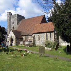
Church of St Michael
137 m
Tombs Of Adam And Richard Ruck, 5 Yards South East Of Porch Of Church Of St Michael
122 m
Ivy Cottage
404 m
Hartlip Place
392 m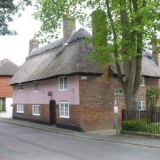
Thatch Cottage
124 m
Grace Cottages
346 m
Barrows Cottages
153 m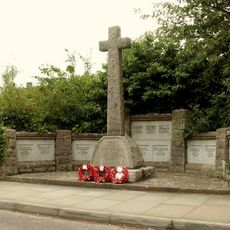
Hartlip War Memorial
59 m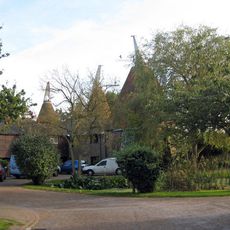
The Cowls The Oast The Press
1.6 km
Farm Storage Building 25 Yards South East Of Place Farm
497 m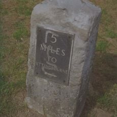
Milestone, between jcts of A20 with South Bush Lane and A20 with Seymour Road
1.6 km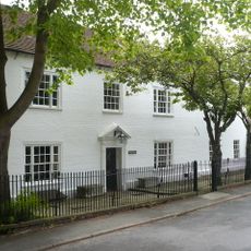
Hartlip House
108 m
Dovecot 30 Yards West Of Place Farm
484 m
Sweepstakes Farmhouse
447 m
Thrognall
1.5 km
Place Farmhouse Garden Wall And Granary
439 m
Wisteria Cottage
154 m
Yew Tree Cottage
130 m
Tomb Of Mary Osborne, 3 Feet East Of South Chapel Of Church Of St Michael
131 m
7 Paradise Cottages And The Old Farmhouse
465 m
Barn 20 Yards South West Of Nunwell Farmhouse
1.2 km
Pooh House The Homestead
1.7 km
Pope's Hall
251 m
Barn 30 Yards North West Of Place Farm
445 m
Nunwell Farmhouse
1.2 km
Cowstead
1.5 km
Chesley House
1.4 km
Warrren Cottage
1.5 kmAvis
Vous avez visité ce lieu ? Touchez les étoiles pour le noter et partager votre expérience ou vos photos avec la communauté ! Essayez maintenant ! Vous pouvez annuler à tout moment.
Trouvez des trésors cachés à chaque coin de rue !
Des petits cafés pittoresques aux points de vue planqués, fuyez la foule et dénichez les lieux qui vous ressemblent vraiment. Notre app vous facilite la vie : recherche vocale, filtres malins, itinéraires optimisés et bons plans partagés par des voyageurs du monde entier. Téléchargez vite pour vivre l'aventure en version mobile !

Une approche inédite de la découverte touristique❞
— Le Figaro
Tous les lieux qui valent la peine d'être explorés❞
— France Info
Une excursion sur mesure en quelques clics❞
— 20 Minutes