Wellers Farmhouse, farmhouse in Sundridge with Ide Hill, Sevenoaks, Kent, UK
Emplacement : Sundridge with Ide Hill
Coordonnées GPS : 51.27577,0.14288
Dernière mise à jour : 21 novembre 2025 à 06:01
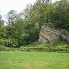
Dryhill Nature Reserve
427 m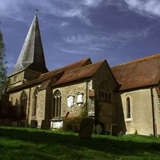
Church of St Mary
964 m
18-22, Church Road
1.1 km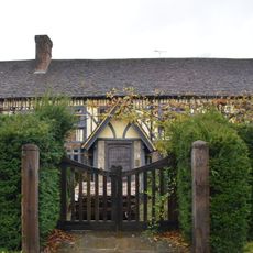
Dryhill Farmhouse
235 m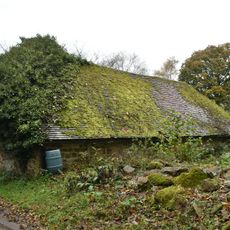
Small Barn To South East Of Dryhill Farmhouse
269 m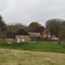
Sundridge Place
991 m
Outbuilding To North East Of Dryhill Farmhouse
209 m
Large Barn To South East Of Sundridge Place With Outbuildings Adjoining
969 m
Boundary Wall To West Of Grounds Of The Old Rectory
1.1 km
Parkview Prospect Cottage
818 m
Wall To South Of The Manor House
1.1 km
Moat Farmhouse
962 m
Lych Gate To West Of Church Of St Mary
1 km
Judge's Cottages
771 m
The Clock House Stores
1.1 km
Garden Walls To East And North Of Sundridge Place
941 m
7-11, Church Road
1.1 km
2-16, High Street
1.1 km
Mill House
1 km
The Old Rectory
1 km
White Shieling
137 m
Large Barn To North West Of Dryhill Farmhouse
222 m
Old Garden Wall To East Of Dryhill Farmhouse
237 m
Bishops Court
808 m
Forecourt Wall To Nos 2 To 16
1.1 km
Retaining Wall And Terrace In Front Of Nos 29-33 Odd
791 m
1 and 3, Chevening Road
1.1 km
Chipstead War Memorial
941 mAvis
Vous avez visité ce lieu ? Touchez les étoiles pour le noter et partager votre expérience ou vos photos avec la communauté ! Essayez maintenant ! Vous pouvez annuler à tout moment.
Trouvez des trésors cachés à chaque coin de rue !
Des petits cafés pittoresques aux points de vue planqués, fuyez la foule et dénichez les lieux qui vous ressemblent vraiment. Notre app vous facilite la vie : recherche vocale, filtres malins, itinéraires optimisés et bons plans partagés par des voyageurs du monde entier. Téléchargez vite pour vivre l'aventure en version mobile !

Une approche inédite de la découverte touristique❞
— Le Figaro
Tous les lieux qui valent la peine d'être explorés❞
— France Info
Une excursion sur mesure en quelques clics❞
— 20 Minutes