
Outbuildings North Of Fir Tree Grange, cottage in Howden-le-Wear, County Durham, England, UK
Emplacement : County Durham
Coordonnées GPS : 54.69900,-1.75348
Dernière mise à jour : 13 novembre 2025 à 14:51
Witton-le-Wear
2.5 km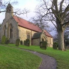
Church of St Philip and St James
2.8 km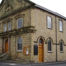
Central Methodist Church
1.8 km
Post Office
2.8 km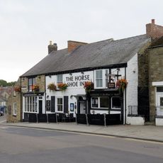
The Horse Shoe Inn
1.9 km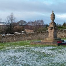
Fir Tree War Memorial Drinking Fountain
2.2 km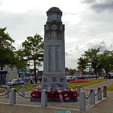
War Memorial, Piers and Chain
1.9 km
Beechburn Grange
2.3 km
Fir Tree Grange
24 m
Low Woodifield Farmhouse
1.8 km
Belfry House
2.8 km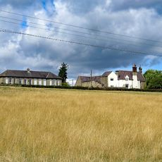
Former Schools
2.3 km
High Woodfield Farmhouse, East And West
2.1 km
Outbuildings To North West Of Beechburn Grange
2.3 km
Fir Tree
2 km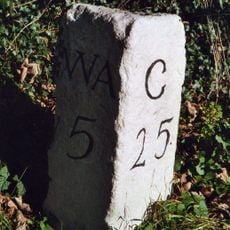
Milestone North Of Witton Le Wear
2.6 km
Church of Our Lady Immaculate and Saint Cuthbert
2.1 km
14 And 15, Post Office Street
2.8 km
Tomb Of Newby Lowson North Of Church Of St Philip And St James
2.8 km
Cart Shed, Stables And Loft And Byre East Of High Woodfield Farmhouse
2 km
Harperley Hall Gate Piers
2.8 km
Presbytery Attached To Church Of Our Lady Immaculate And Saint Cuthbert
2.1 km
Helmington Row and Sunnybrow War Memorial
2.3 km
Howden-le-Wear War Memorial
503 m
Gate Piers, Gates, Walls And Railings In Front Of Former Schools
2.3 km
Crook Golf Club
2.8 km
Œuvre d’art, sculpture
2.5 km
Observation Tower
2.4 kmVous avez visité ce lieu ? Touchez les étoiles pour le noter et partager votre expérience ou vos photos avec la communauté ! Essayez maintenant ! Vous pouvez annuler à tout moment.
Trouvez des trésors cachés à chaque coin de rue !
Des petits cafés pittoresques aux points de vue planqués, fuyez la foule et dénichez les lieux qui vous ressemblent vraiment. Notre app vous facilite la vie : recherche vocale, filtres malins, itinéraires optimisés et bons plans partagés par des voyageurs du monde entier. Téléchargez vite pour vivre l'aventure en version mobile !

Une approche inédite de la découverte touristique❞
— Le Figaro
Tous les lieux qui valent la peine d'être explorés❞
— France Info
Une excursion sur mesure en quelques clics❞
— 20 Minutes