Norton Court, building in Chart Sutton, Maidstone, Kent, UK
Emplacement : Chart Sutton
Coordonnées GPS : 51.22185,0.57920
Dernière mise à jour : 23 novembre 2025 à 18:27
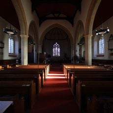
Church of St Mary, Sutton Valence
1.2 km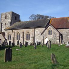
Church of St Michael
746 m
Mounting Block About 20 Metres West North West Of Church Of St Michael
725 m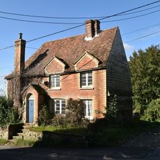
Ivy Cottage
895 m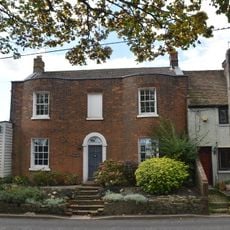
Osborne House
1 km
Former Granary About 15 Metres North Of Chart Place Cottages
660 m
Marshalls Place
854 m
Stable To South Of Rectory Farmhouse
1.1 km
Lested Lodge
679 m
Barns And Outbuildings To North East Of Fir Tree Farmhouse
547 m
Oasthouse About 17 Metres East Of Fir Tree Farmhouse
526 m
The Moorings
612 m
Sutton Platt Cottage
1 km
Rectory Farmhouse
1.1 km
Homewell House
944 m
The Plough Inn
982 m
Court Farmhouse And Barn
687 m
Oast House About 40 Metres North Of Warmlake Farmhouse
917 m
Garage At Fir Tree Farmhouse
529 m
Ladds Court
834 m
Chart Place
689 m
Rectory Farmhouse
1.1 km
The Old Rectory
1.1 km
Wentways
115 m
Newhouse Farmhouse
474 m
House Attached To North Of Post Office Stores
602 m
Barn About 40 Metres South South West Of Park House Farmhouse
1.1 km
Chart Place Cottages
680 mAvis
Vous avez visité ce lieu ? Touchez les étoiles pour le noter et partager votre expérience ou vos photos avec la communauté ! Essayez maintenant ! Vous pouvez annuler à tout moment.
Trouvez des trésors cachés à chaque coin de rue !
Des petits cafés pittoresques aux points de vue planqués, fuyez la foule et dénichez les lieux qui vous ressemblent vraiment. Notre app vous facilite la vie : recherche vocale, filtres malins, itinéraires optimisés et bons plans partagés par des voyageurs du monde entier. Téléchargez vite pour vivre l'aventure en version mobile !

Une approche inédite de la découverte touristique❞
— Le Figaro
Tous les lieux qui valent la peine d'être explorés❞
— France Info
Une excursion sur mesure en quelques clics❞
— 20 Minutes