
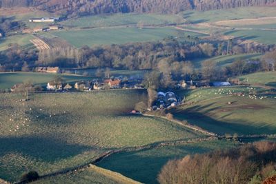
Kildale, localité britannique du comté anglais de North Yorkshire
Emplacement : Hambleton
Coordonnées GPS : 54.47890,-1.03193
Dernière mise à jour : 3 mars 2025 à 13:14

Gisborough Moor
2.7 km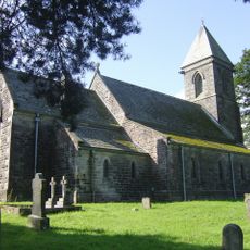
St Cuthbert's Church
2.4 km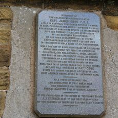
Captain Cook Monument
3.8 km
Commondale War Memorial
3.5 km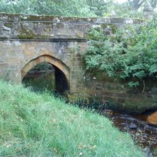
Baysdale Abbey Bridge
3 km
Percy Rigg Cross
3 km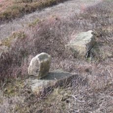
Pair Of Boundary Stones, Approximately 2025 Metres To South Of Home Lowcross At Ngr Nz599 123
3.9 km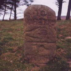
Guide Stone On North Side Of Road From Stokesley
2.9 km
Hob Cross Approximately 875 Metres To South Of Tidkinhow Farmhouse At Ngr Nz645 133
4 km
Commondale Shepherds' Memorial
2.8 km
Boundary Stone, Circa 990 Metres North East Of Skelderskew Farmhouse
4.3 km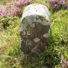
Boundary Stone West Of Path To Captain Cook Monument
3.9 km
Boundary Stone Approximately 1260 Metres To South Of Highcliff Farmhouse At Ngr Nz605 121
3.3 km
Boundary Stone, Approximately 1350 Metres To South Of Highcliff Farmhouse At Ngr Nz604 120
3.3 km
Boundary Stone, Approximately 1950 Metres To South Of Home Farmhouse Hutton Lowcross At Ngr Nz595 124
4.3 km
Boundary Stone Approximately 1300 Metres To South Of Highcliff Farmhouse At Ngr Nz603 121
3.5 km
Boundary Stone, Approximately 1300 Metres To South West Of Highcliff Farmhouse At Ngr Nz600 123
3.8 km
Boundary Stone, Approximately 1310 Metres To South Of Highcliff Farmhouse At Ngr Nz605 121
3.3 km
Boundary Stone East Of Path To Captain Cook Monument
3.8 km
Boundary Stone Approximately 400 Metres To South Of Highcliff Farmhouse At Ngr Nz606 119
3.2 km
Boundary Stone, Approximately 1430 Metres To South Of Highcliff Farmhouse At Ngr Nz605 119
3.2 km
Boundary Stone Approximately 550 Metres South West Of Tidkinhow Farmhouse At Ngr Nz643 137
4.3 km
Boundary Stone Approximately 1225 Metres To South Of Highcliff Farmhouse At Ngr Nz605 121
3.4 km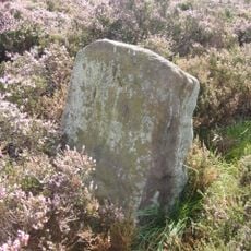
Boundary Stone Approximately 1940 Metres To South Of Home Farmhouse Hutton Lowcross At Ngr Nz595 124
4.2 km
Boundary Stone, Circa 1,020 Metres North Of Skelderskew Farmhouse
4.1 km
Boundary Stone, Circa 1,400 Metres South Of Tidkinhow Farmhouse
3.7 km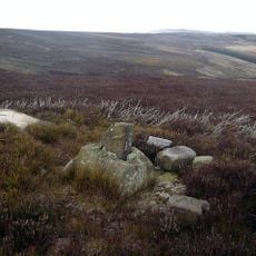
Wayside cross known as Baysdale Cross on Middle Head Intake 1000m south west of Baysdale Abbey
4.3 km
Guidestone, boundary N Yorks/Richmond & Cleveland
3.2 kmVous avez visité ce lieu ? Touchez les étoiles pour le noter et partager votre expérience ou vos photos avec la communauté ! Essayez maintenant ! Vous pouvez annuler à tout moment.
Trouvez des trésors cachés à chaque coin de rue !
Des petits cafés pittoresques aux points de vue planqués, fuyez la foule et dénichez les lieux qui vous ressemblent vraiment. Notre app vous facilite la vie : recherche vocale, filtres malins, itinéraires optimisés et bons plans partagés par des voyageurs du monde entier. Téléchargez vite pour vivre l'aventure en version mobile !

Une approche inédite de la découverte touristique❞
— Le Figaro
Tous les lieux qui valent la peine d'être explorés❞
— France Info
Une excursion sur mesure en quelques clics❞
— 20 Minutes