
Wentnor, village britannique
Emplacement : Shropshire
Coordonnées GPS : 52.52900,-2.91000
Dernière mise à jour : 9 mars 2025 à 01:20

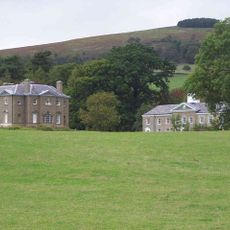
Linley Hall
3.7 km
Church of St Peter
4.2 km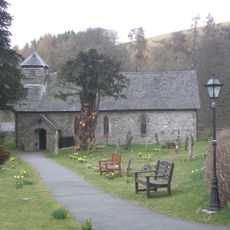
Church of St Margret
4.6 km
Church of All Saints
2 km
Church of the Holy Trinity
5.1 km
Church of St John the Baptist
3.3 km
Church of St Michael
78 m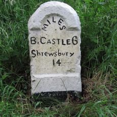
Milestone Approximately 50M North Of Upper Mill Farmhouse
1.4 km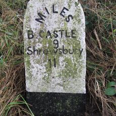
Milestone Approximately 200M North-West Of The Old School House
5.5 km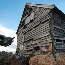
Barn approximately 60 metres to north-east of Lower Lea Farmhouse
4.7 km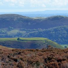
Bodbury Ring: a large univallate hillfort on the summit of Bodbury Hill.
6.5 km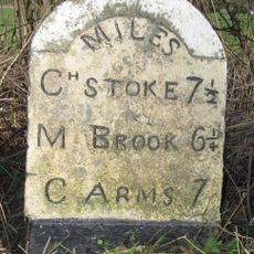
Milestone Approximately 170 Metres To South-West Of Eaton Bridge
3.4 km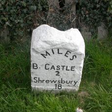
Milestone Approximately 470 Metres To North Of Junction Of A489 With B4383
4.3 km
Stables At Linley Hall
3.7 km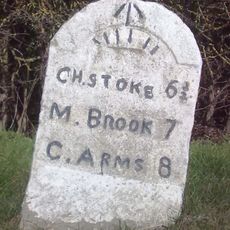
Milestone Approximately 1,000 Metres To North-East Of Lea Castle
3.8 km
Lydham Castle
5.2 km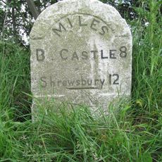
Milestone Approximately 120M North-East Of The Horse Shoe Inn
3.9 km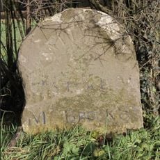
Milestone Approximately 230 Metres North West Of Junction Of A489 With B4383
4.6 km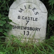
Milestone Approximately 300M North-East Of England Shelve Farmhouse
2.8 km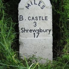
Milestone Approximately 130 Metres To South-West Of Greenfield Cottages
3.1 km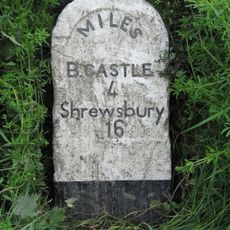
Milestone Approximately 15M North-West Of Quarry Cottages
1.9 km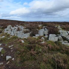
Tor cairn on Stiperstones, 130m SSE of Manstone Rock.
6 km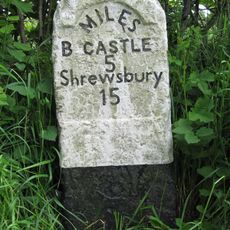
Milestone Approximately 150M South Of Walkmill Bridge
490 m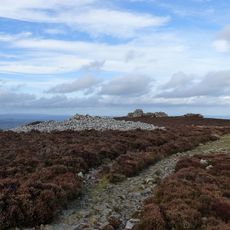
Round cairn on Stiperstones, 350m SSW of the Devil's Chair
6.3 km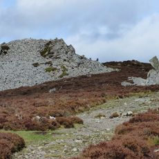
Round cairn on Stiperstones, 150m south of Manstone Rock.
6 km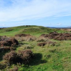
Shooters Hut disc barrow, 1500m south-west of Duckley Nap.
4.6 km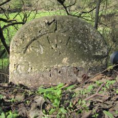
Milestone, Myndmill; N of Eyton jcn
4.5 km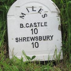
Milestone, New Leasowes Farm
7 kmAvis
Vous avez visité ce lieu ? Touchez les étoiles pour le noter et partager votre expérience ou vos photos avec la communauté ! Essayez maintenant ! Vous pouvez annuler à tout moment.
Trouvez des trésors cachés à chaque coin de rue !
Des petits cafés pittoresques aux points de vue planqués, fuyez la foule et dénichez les lieux qui vous ressemblent vraiment. Notre app vous facilite la vie : recherche vocale, filtres malins, itinéraires optimisés et bons plans partagés par des voyageurs du monde entier. Téléchargez vite pour vivre l'aventure en version mobile !

Une approche inédite de la découverte touristique❞
— Le Figaro
Tous les lieux qui valent la peine d'être explorés❞
— France Info
Une excursion sur mesure en quelques clics❞
— 20 Minutes