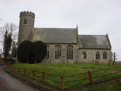
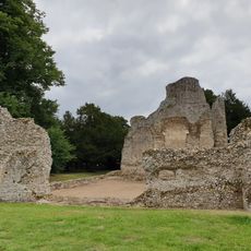
Weeting-with-Broomhill, civil parish in Norfolk, United Kingdom
Emplacement : Breckland District
Coordonnées GPS : 52.47317,0.62899
Dernière mise à jour : 9 mars 2025 à 06:52
Grimes Graves
3 km
Thetford Forest
1.9 km
Lynford Hall
5.6 km
Château de Weeting
891 m
Brandon Country Park
4.2 km
London Road Industrial Estate, Brandon
4.1 km
Crown Hotel
4.8 km
Church of St Mary
3.4 km
Church of St Leonard
4.6 km
Church of St James
5.4 km
Church of St Peter
3.4 km
All Saints
4.8 km
Church of St Mary
5.5 km
Church of St Mary
1 km
Church of Our Lady of Consolation
5.1 km
Ice House At Billiard Room Cottage
3.1 km
Lancaster HK773 crash memorial, Mundford
2.4 km
Cross-base 2 Metres North West Of Church Of St Mary
3.4 km
Hockwold cum Wilton War Memorial
5.4 km
Brandon War Memorial
3.3 km
Village Cross
5.3 km
Wayside cross known as Stump Cross in Mount Ephraim Plantation
2.4 km
Bowl barrow 230m south west of Little Lodge Farm
5.6 km
Weeting Castle moated site and 12th century manor house with post-medieval ice house
886 m
Milestone, 100m S of entrance to caravan park at Methwold Warren
5.5 km
Milestone, Forty Acre Strip
4 km
Milestone, N of cross-roads
3.7 km
Milestone, West Tofts Heath
5.2 kmAvis
Vous avez visité ce lieu ? Touchez les étoiles pour le noter et partager votre expérience ou vos photos avec la communauté ! Essayez maintenant ! Vous pouvez annuler à tout moment.
Trouvez des trésors cachés à chaque coin de rue !
Des petits cafés pittoresques aux points de vue planqués, fuyez la foule et dénichez les lieux qui vous ressemblent vraiment. Notre app vous facilite la vie : recherche vocale, filtres malins, itinéraires optimisés et bons plans partagés par des voyageurs du monde entier. Téléchargez vite pour vivre l'aventure en version mobile !
Une approche inédite de la découverte touristique❞
— Le Figaro
Tous les lieux qui valent la peine d'être explorés❞
— France Info
Une excursion sur mesure en quelques clics❞
— 20 Minutes