
Roma Point Bridge, bridge under construction in the Philippines
Emplacement : Quezon
Coordonnées GPS : 13.99917,122.17917
Dernière mise à jour : 23 septembre 2025 à 17:46
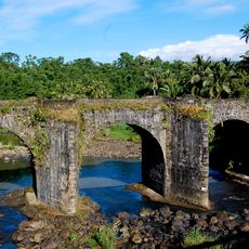
Malagonlong Bridge
60.8 km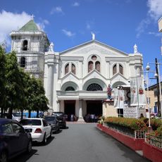
Lucena Cathedral
61.6 km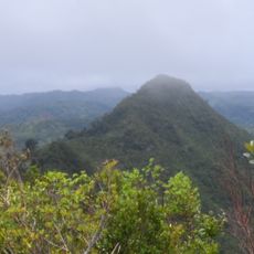
Quezon Protected Landscape
46.5 km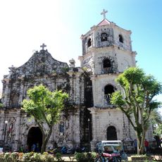
Gumaca Cathedral
12.2 km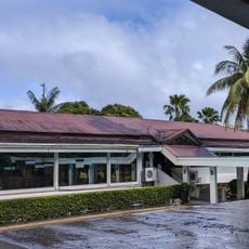
Nawawalang Paraiso
65.9 km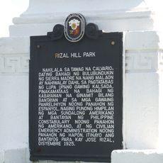
Rizal Hill Park historical marker
52.8 km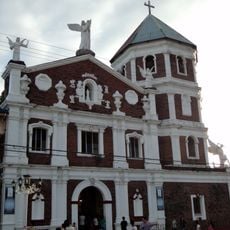
Atimonan Church
27.8 km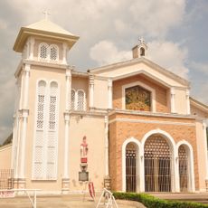
Mauban Church
52.9 km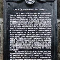
Casa de Comunidad de Tayabas historical marker
63.5 km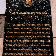
The Church of Gumaca historical marker
12.2 km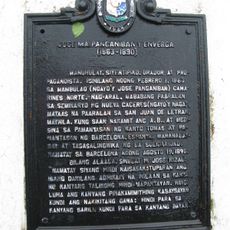
Jose Ma. Panganiban y Enverga historical marker
64.1 km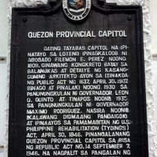
Quezon Provincial Capitol historical marker
61.6 km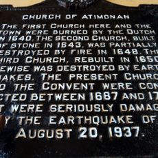
Church of Atimonan historical marker
27.8 km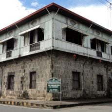
Casa Comunidad of Tayabas
63.5 km
Catanauan Cove
44.8 km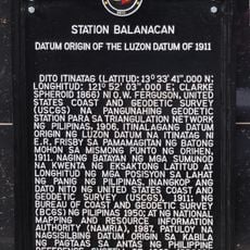
Station Balanacan historical marker
59.3 km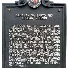
Battle of Barrio Piis historical marker
65.1 km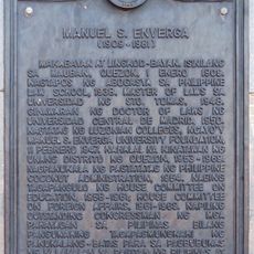
Manuel S. Enverga historical marker
52.6 km
Pueblo por la Playa
52.5 km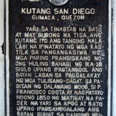
Fort San Diego historical marker
12 km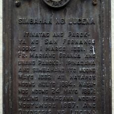
Church of Lucena historical marker
61.6 km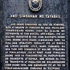
The Church of Tayabas historical marker
63.6 km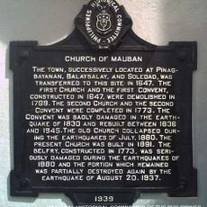
Church of Mauban historical marker
52.9 km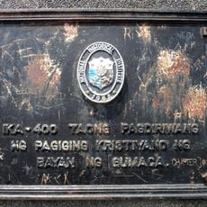
400th Anniversary of the Christianization of the Town of Gumaca historical marker
12.5 km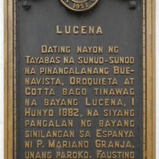
Lucena historical marker
61.6 km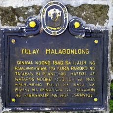
Malagonlong Bridge historical marker
60.8 km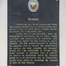
Tayabas historical marker
63.4 km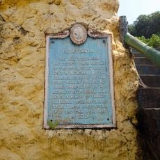
Iskong Bantay historical marker
27.8 kmAvis
Vous avez visité ce lieu ? Touchez les étoiles pour le noter et partager votre expérience ou vos photos avec la communauté ! Essayez maintenant ! Vous pouvez annuler à tout moment.
Trouvez des trésors cachés à chaque coin de rue !
Des petits cafés pittoresques aux points de vue planqués, fuyez la foule et dénichez les lieux qui vous ressemblent vraiment. Notre app vous facilite la vie : recherche vocale, filtres malins, itinéraires optimisés et bons plans partagés par des voyageurs du monde entier. Téléchargez vite pour vivre l'aventure en version mobile !

Une approche inédite de la découverte touristique❞
— Le Figaro
Tous les lieux qui valent la peine d'être explorés❞
— France Info
Une excursion sur mesure en quelques clics❞
— 20 Minutes