
General Nakar Municipal Hall, government building in General Nakar, Quezon
Emplacement : General Nakar
Coordonnées GPS : 14.75708,121.62092
Dernière mise à jour : 8 mars 2025 à 00:16

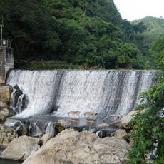
Wawa Dam
46.3 km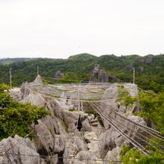
Masungi Georeserve
34.8 km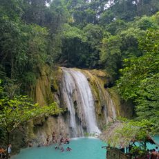
Daranak Falls
19.5 km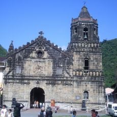
Paete Church
46.2 km
Pamitinan Protected Landscape
46.7 km
Pamitinan Cave
46.5 km
Upper Marikina River Basin Protected Landscape
44.8 km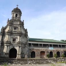
Morong Church
46.1 km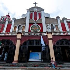
Siniloan Church
41.8 km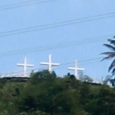
Three Crosses of Paete
45.8 km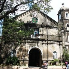
Cainta Church
58 km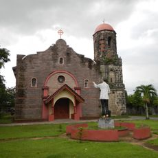
Mabitac Church
42.3 km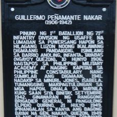
Guillermo Peñamante Nakar historical marker
26 m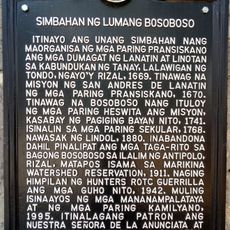
Church of Old Bosoboso historical marker
43.2 km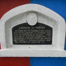
Battle of Mabitac historical marker
42.1 km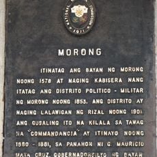
Morong historical marker
49.3 km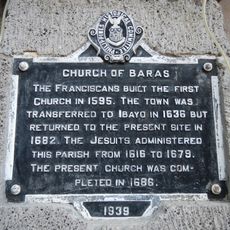
Church of Baras historical marker
46.1 km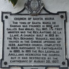
Church of Santa Maria historical marker
38.3 km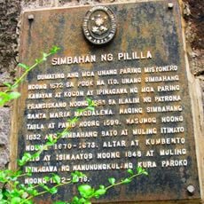
Pililla Church historical marker
45.8 km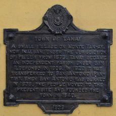
Town of Tanay historical marker
46.3 km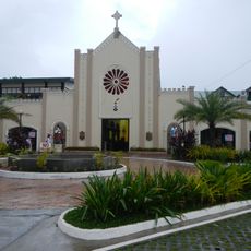
Infanta Cathedral
3.3 km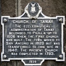
Church of Tanay historical marker
46.3 km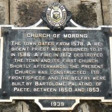
Church of Morong historical marker
49.3 km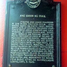
The Town of Pakil historical marker
44.6 km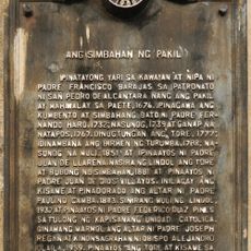
The Church of Pakil historical marker
44.6 km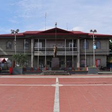
Commandancia
49.3 km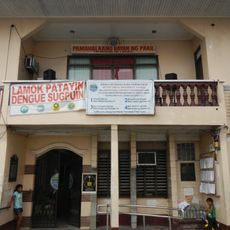
Pakil Municipal Hall
44.6 km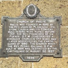
Church of Paete historical marker
46.2 kmVous avez visité ce lieu ? Touchez les étoiles pour le noter et partager votre expérience ou vos photos avec la communauté ! Essayez maintenant ! Vous pouvez annuler à tout moment.
Trouvez des trésors cachés à chaque coin de rue !
Des petits cafés pittoresques aux points de vue planqués, fuyez la foule et dénichez les lieux qui vous ressemblent vraiment. Notre app vous facilite la vie : recherche vocale, filtres malins, itinéraires optimisés et bons plans partagés par des voyageurs du monde entier. Téléchargez vite pour vivre l'aventure en version mobile !

Une approche inédite de la découverte touristique❞
— Le Figaro
Tous les lieux qui valent la peine d'être explorés❞
— France Info
Une excursion sur mesure en quelques clics❞
— 20 Minutes