
Ilihan, barangay of the Philippines in the municipality of Tabogon, Cebu
Emplacement : Tabogon
Altitude : 180 m
Coordonnées GPS : 10.90528,123.97028
Dernière mise à jour : 12 octobre 2025 à 11:46

Cebu Taoist Temple
64.3 km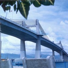
Marcelo Fernan Bridge
64.4 km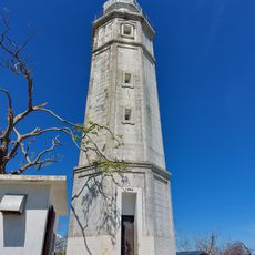
Phare de Bagacay
58.4 km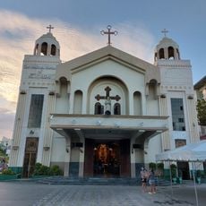
Mandaue Church
64.4 km
Ogtong Cave Resort
33.4 km
Kalanggaman Island Beach
38.6 km
Paradise Beach
34 km
Upside Down World Cebu
64.5 km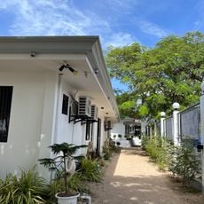
Paradizzo Beach Resort
31.4 km
Sugar Beach
32.9 km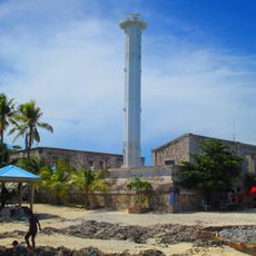
Phare de Capitancillo
17.4 km
Adventure Cafe
57.1 km
Boardwalk Beach Resort
50.3 km
Tops Lookout
60.5 km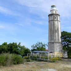
Phare de Bagacay
58.2 km
JVR Island in the Sky Resort
56.9 km
La Tegola (Busay)
59.6 km
San Juan Beach
47.8 km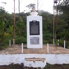
Ramon Magsaysay historical marker
53.4 km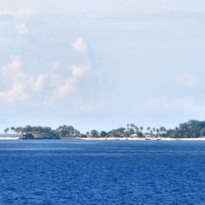
Malapascua Island Lighthouse
51.1 km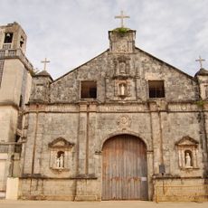
Saints Peter and Paul Parish Church
40 km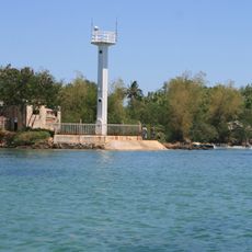
Bantayan Lighthouse
41.9 km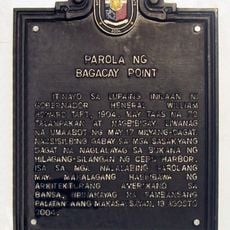
Lighthouse of Bagacay Point historical marker
58.3 km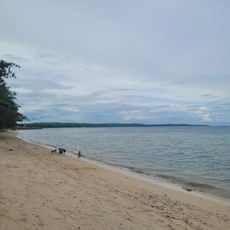
San Remigio Public Beach
20 km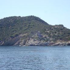
Poro Island lighthouse
57 km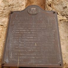
The Church of Bantayan historical marker
40 km
Talisay Public Beach
59 km
Bawok-bawok Beach
63.6 kmVous avez visité ce lieu ? Touchez les étoiles pour le noter et partager votre expérience ou vos photos avec la communauté ! Essayez maintenant ! Vous pouvez annuler à tout moment.
Trouvez des trésors cachés à chaque coin de rue !
Des petits cafés pittoresques aux points de vue planqués, fuyez la foule et dénichez les lieux qui vous ressemblent vraiment. Notre app vous facilite la vie : recherche vocale, filtres malins, itinéraires optimisés et bons plans partagés par des voyageurs du monde entier. Téléchargez vite pour vivre l'aventure en version mobile !

Une approche inédite de la découverte touristique❞
— Le Figaro
Tous les lieux qui valent la peine d'être explorés❞
— France Info
Une excursion sur mesure en quelques clics❞
— 20 Minutes